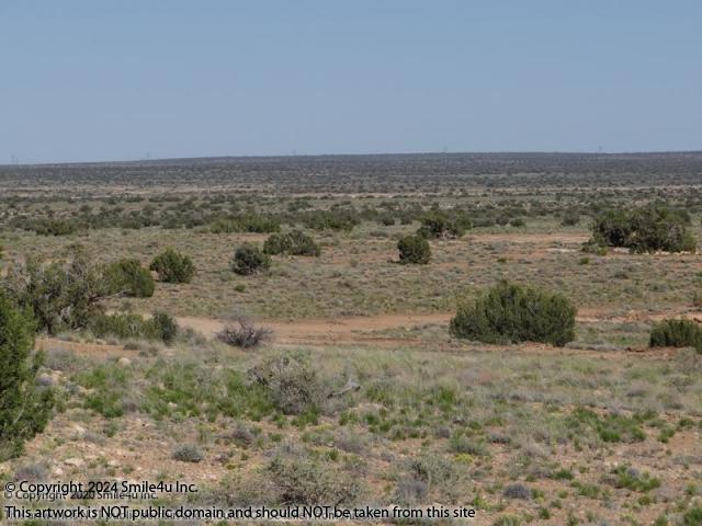
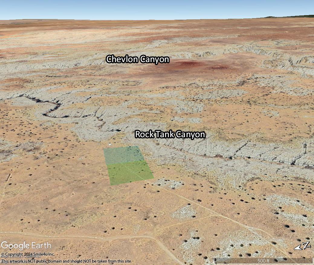
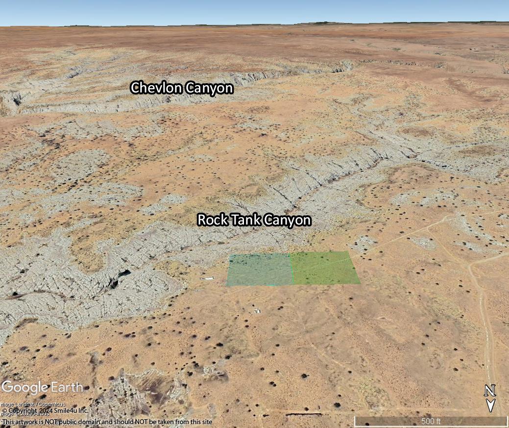
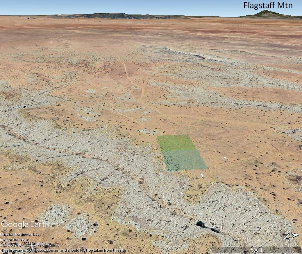
It's a pretty spot about 30 minutes S of Winslow, Arizona about 1 mile from Chevlon Canyon - a fun place to go explore for petrified wood! This photo is looking across the wide open valley towards the property. There's junipers sprinkled about and very few people out here, rural and off grid.
2.5 Acre Lots 1/2 Hour S of Winslow, Arizona by Chevlon Canyon, a Tributary to the Little Colorado River
About 3.5 hours NE of Phoenix by Holbrook and Flagstaff in Navajo County,
A View of the San Francisco Peaks with Humpherys Peak at 12,633 Feet, the Tallest Peak in Arizona!
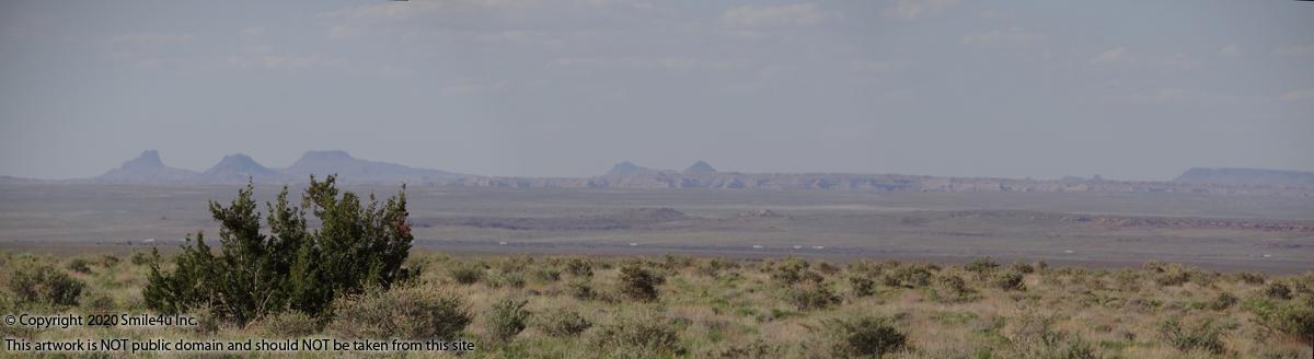
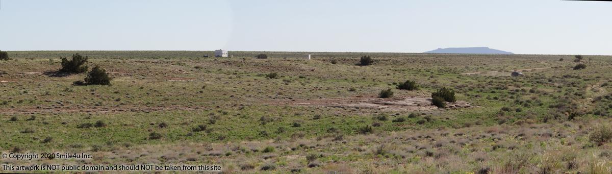
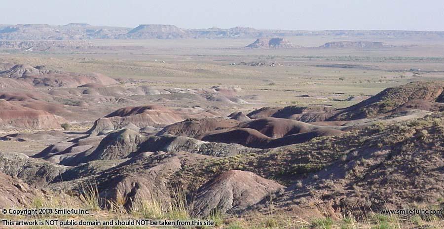
Views of the Painted Desert Popping Out of the Colorado Plateau Across the Valley
I've Collected a Lot of Petrified Wood in this Area!
Call Char Mon - Sun 360-550-8943
Private Land Investor - I Own Everything I Have For Sale!
180 Days Same As Cash Owner Financing With $250 Down!
Your Choice of Lots:
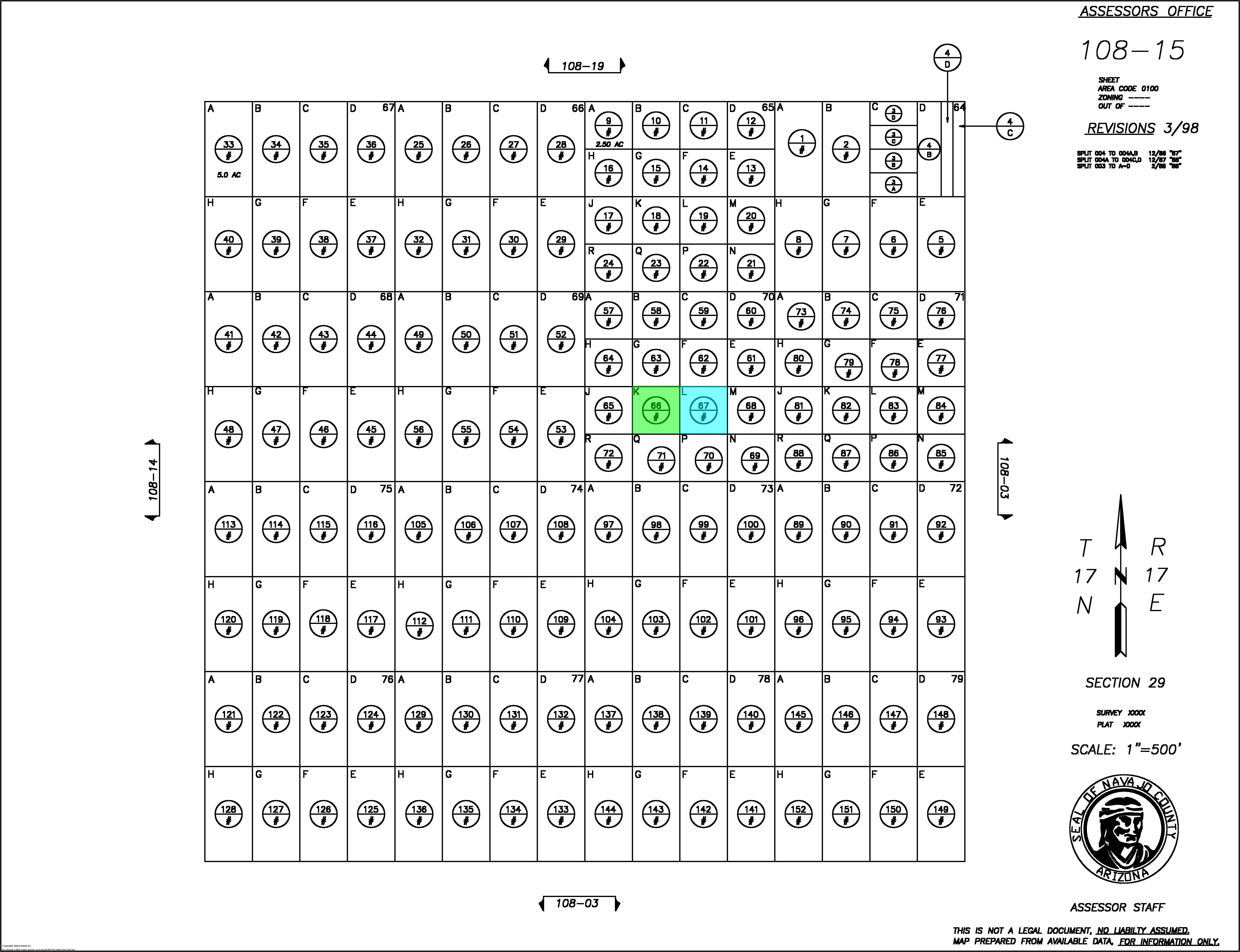
T17N R17E Sec 29 Track K-70 Available
T17N R17E Sec 29 Track L-70 Available
Status: Available
Sale: $5,500.00 Cash Per Lot or Best Offer.
See Listing For Owner Financing Price and Terms
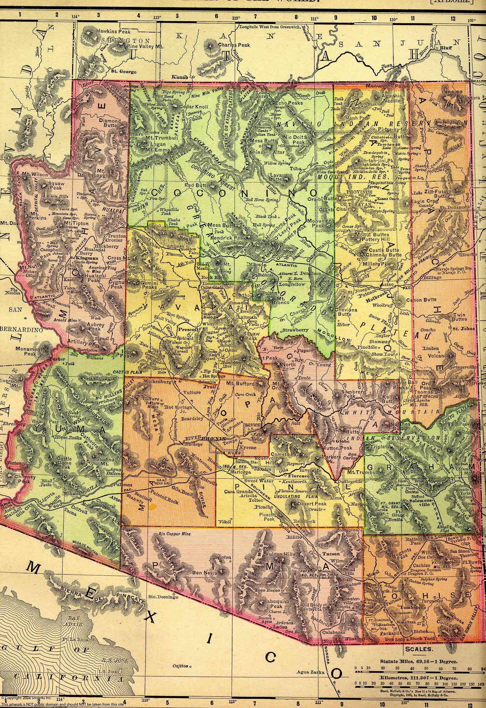
State: AZ
County: Navajo

Parcels
Listing Details
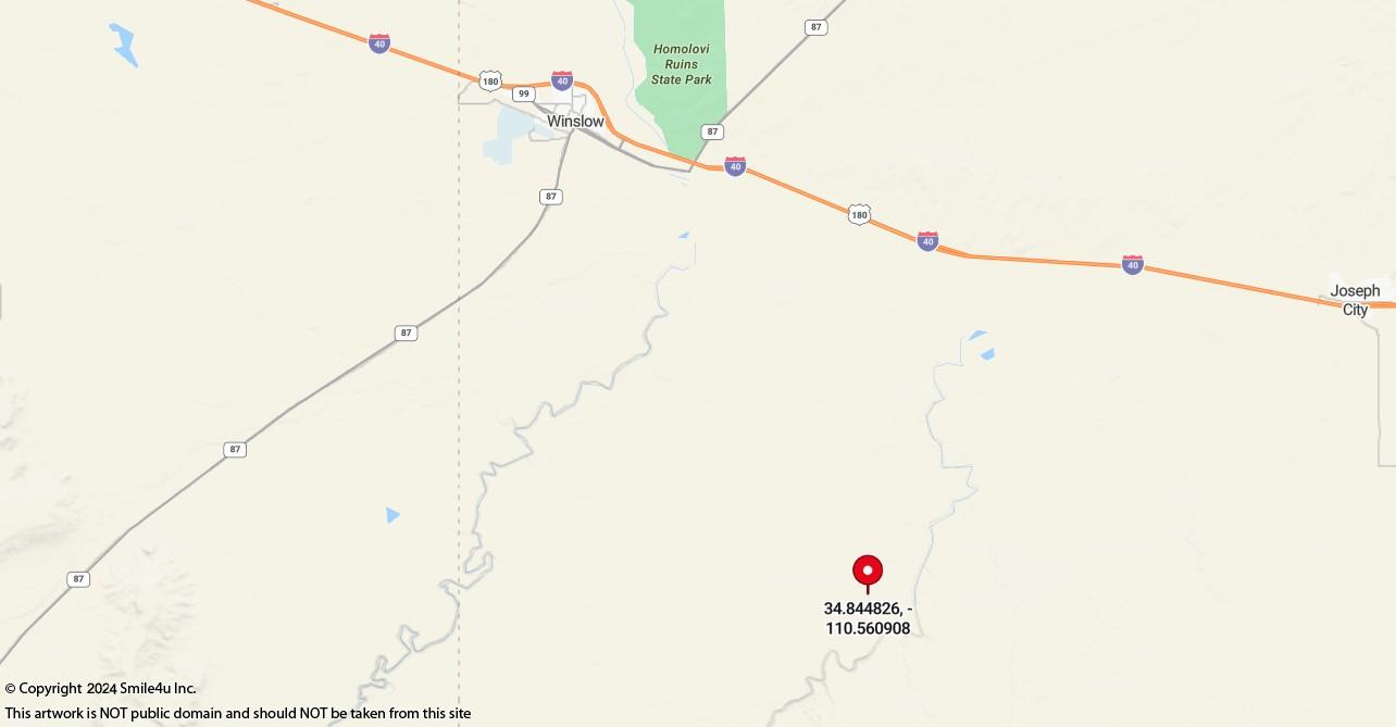
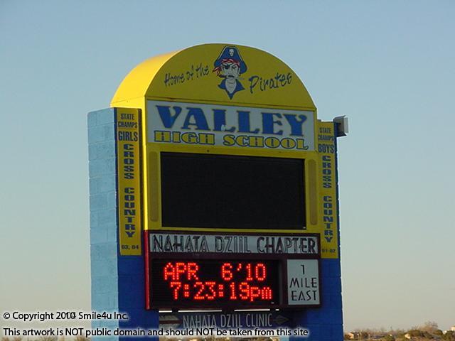
Holbrook is 30 miles NE
Flagstaff is 79 miles NW
Gallup is 149 miles E
Phoenix is 220 miles SW
Albuquerque is 288 miles E
Las Vegas is 324 miles W
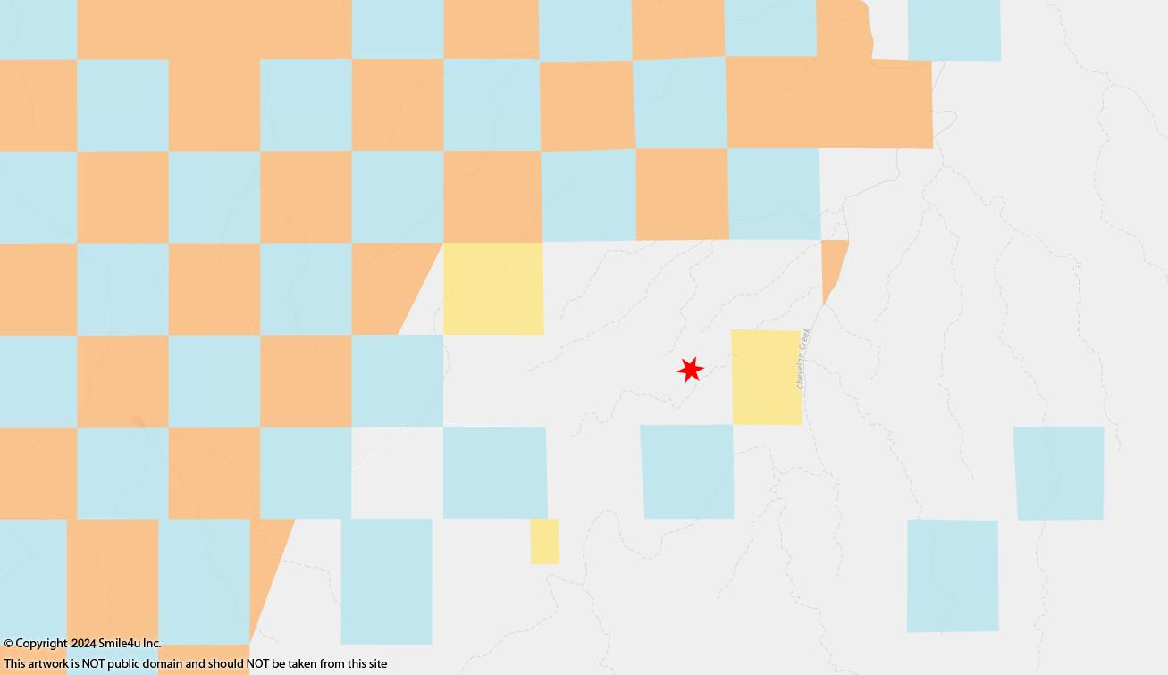
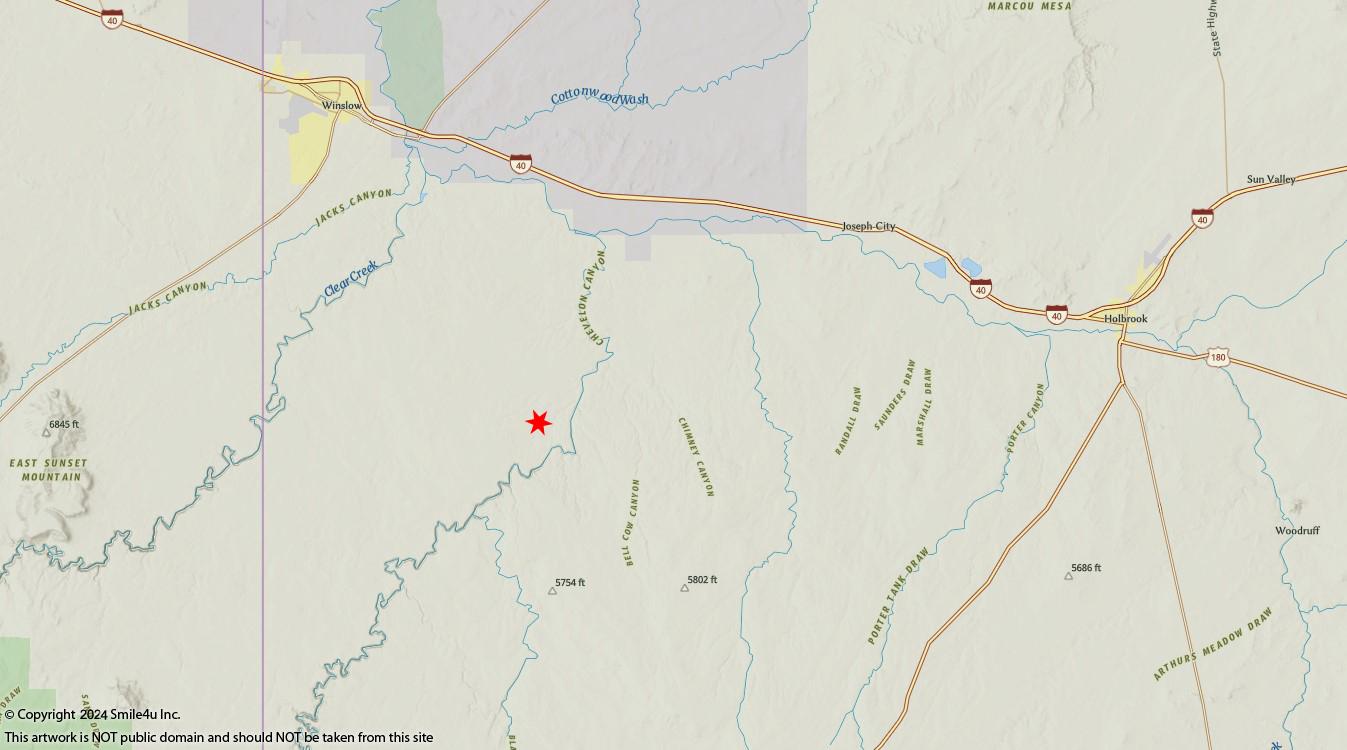
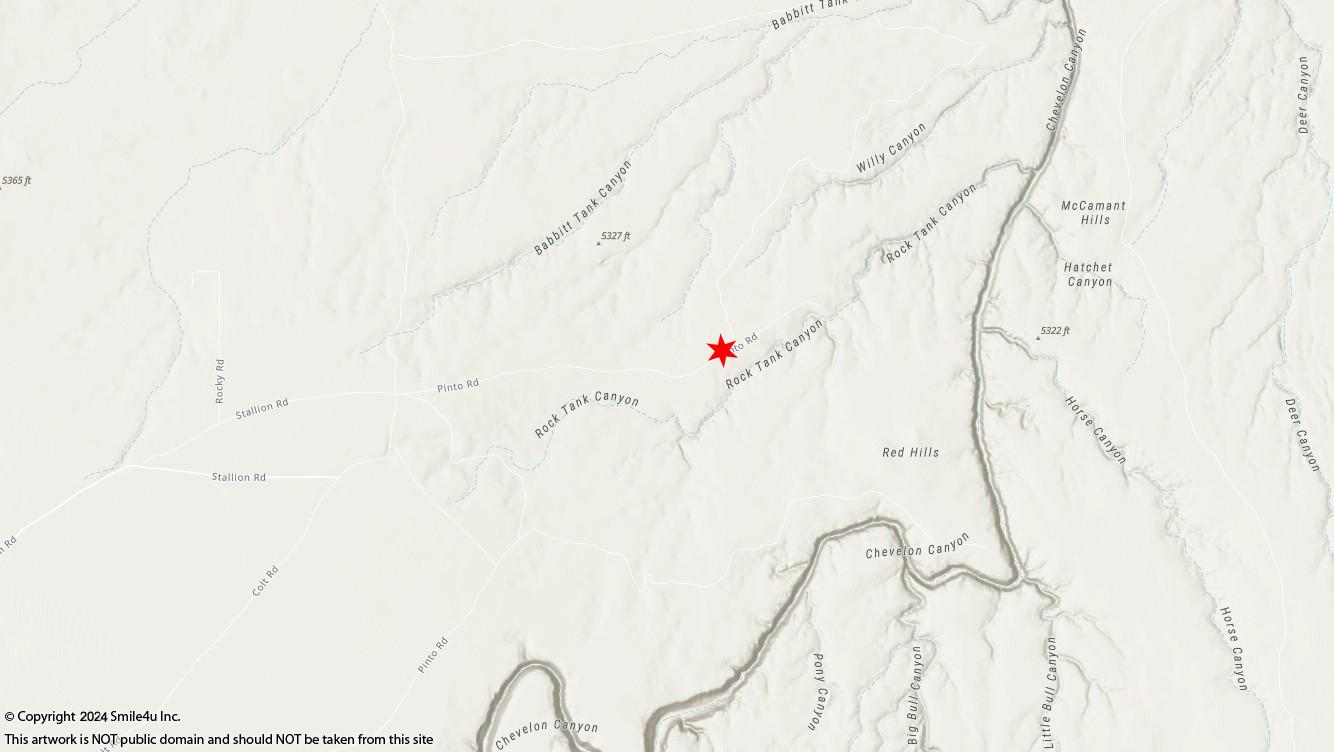
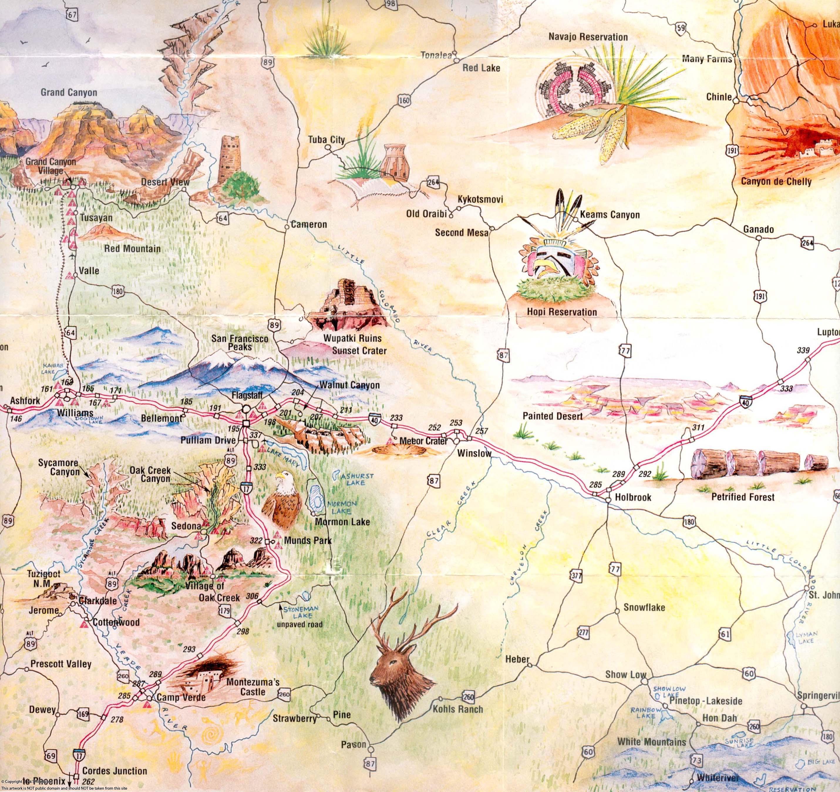
We included a map that shows which roads and mileage from the town of Winslow to the property.
My GPS tells me to take the wrong way. I suggest either printing out that map or downloading it to your cell phone. You could try and put the gps coordinates into your phone but what if your phone doesn't work when you get out there.
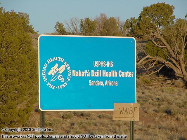
Click here to visit the Arizona Department of Water Resources website for information about well permits.
Click here to visit the Registry of Wells in Arizona to research the depth of any wells in the area.
Click here to visit the Arizona Department of Environmental Qualitys website for information about septics.
Must have 100 feet between septic and well and 50 feet setback off property lines.
30 days RV use without permit or 1 year with a building permit.
Click Here to read the Navajo County zoning for A General.
Property Photos
All of the photos were taken in May 2020 of T17N R17E Sec 30 W2NE4 Lot 4 Aka Tract C-29 and the surrounding views.
To view larger maps/photos just simply click the thumbnail to expand. You can scroll by using the arrow keys on your keyboard as well.
To view the maps/photos in a larger window hover your mouse over the small image, right click and then choose "Open Link".
Make sure to check the map section to see where photos were taken in relation to the property being sold in case the above named property is not the property being sold in this listing.
Your choice of 2 adjoining 2.5 acre lots for sale 1/2 hour Sof Winslow, Arizona. They sit about 1 mile from Chevelon Canyon, a tributary to the Little Colorado River! There's a view of the San Francisco Peaks in Flagstaff and the Painted Desert! It's close to Holbrook between Flagstaff and Gallup, NM about 3.5 hours NE of Phoenix.
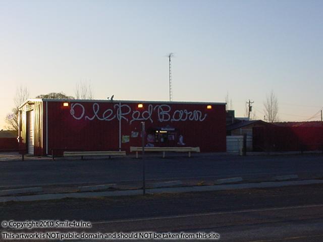
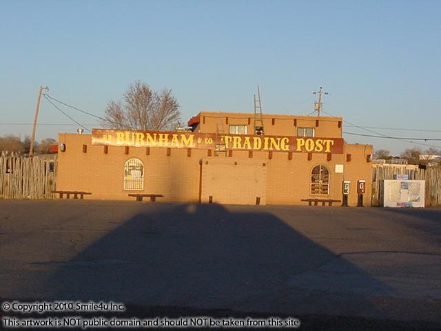
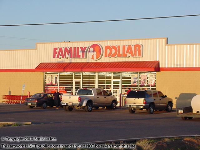
I have not had a chance to view these and all of the photos were taken 1 mile NW in May 2020. One of the main drags that runs thru the area and seen in the photos goes right thru the property. There are a ton of roads out to the area and the GPS definitely doesn't line up with what’s going on so be sure and read the notes below and view the maps on how to reach the properties. I included what my GPS looks like and you can see they are off a bit.
.JPG)
.JPG)
This photo was taken looking S/SE and this property sits 1 mile SE out there somewhere! The aerial photos show a few juniper trees and sandstone at the edge of the west lot.
.JPG)
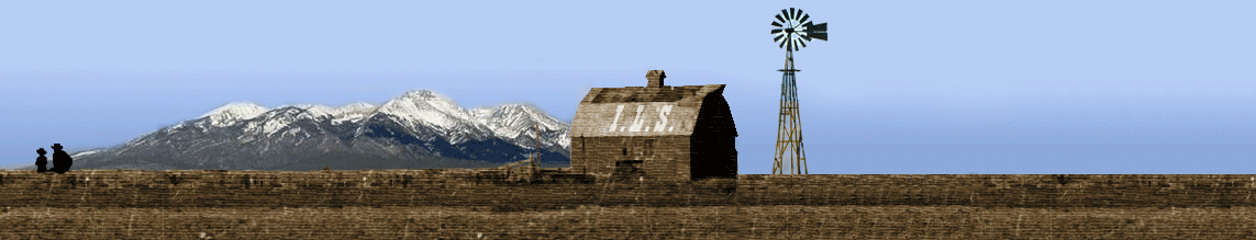
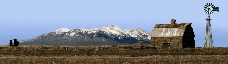
My little man "marking" the property - RIP BUD THE STUD!
This is a good representation of what the flat sandstone looks like.
.JPG)
To the NW is a pretty view across the valley of San Francisco Paks which sit just to the N of Flagstaff with Humphreys Peak at 12,633 Feet, the tallest peak in Arizona!
.JPG)
From the N to the NE is a view of the Painted Desert hills popping out of the Colorado Plateau. This is the home of the Hopi Community of Second Mesa.
.JPG)
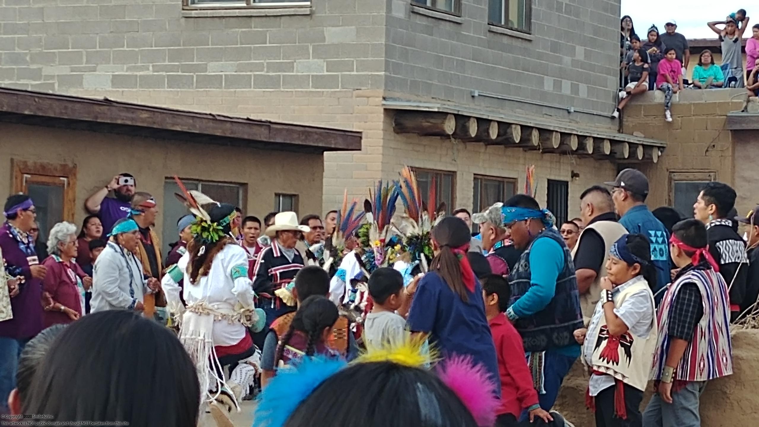
I have a couple friends, Robert and Marlinda, who invited me to attend the Rain Ceremony atop this mesa. He is Hopi-Tewa and grew up running around on top of this mesa and she is Navajo. Oh what an experience of a lifetime! I have often dreamed of attending a private ceremony and was so honored being present. It's such a fascinating culture with old ways of life and medicine. It is sacred and not something I took a lot of photos of. I did ask permission to share these! Dream Big!
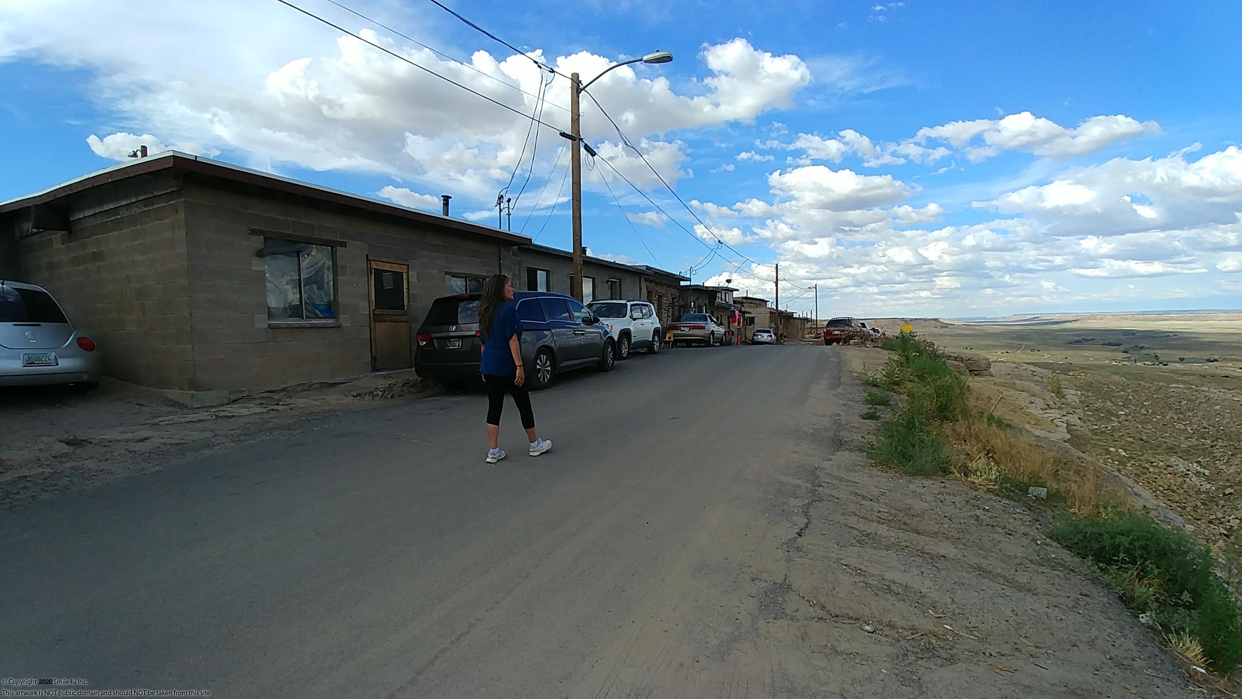
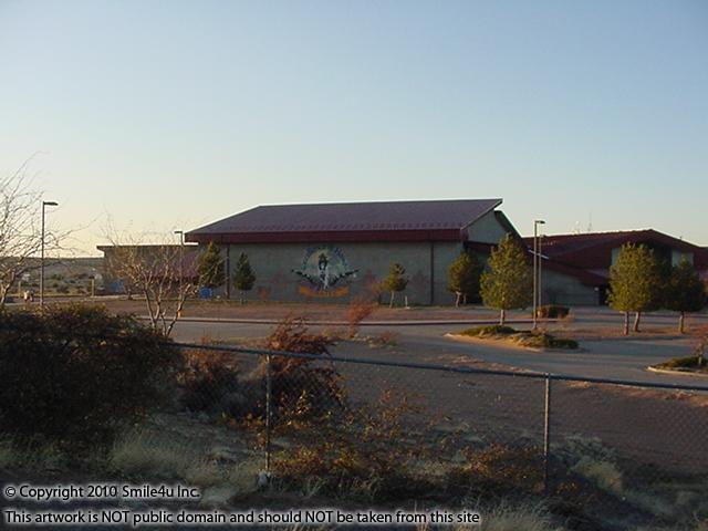
There is one of the neighbors you pass by to get out here. The property is surrounded by a metal fence. There's a few other neighbors sprinkled about to the NW and a cow stock water tank.
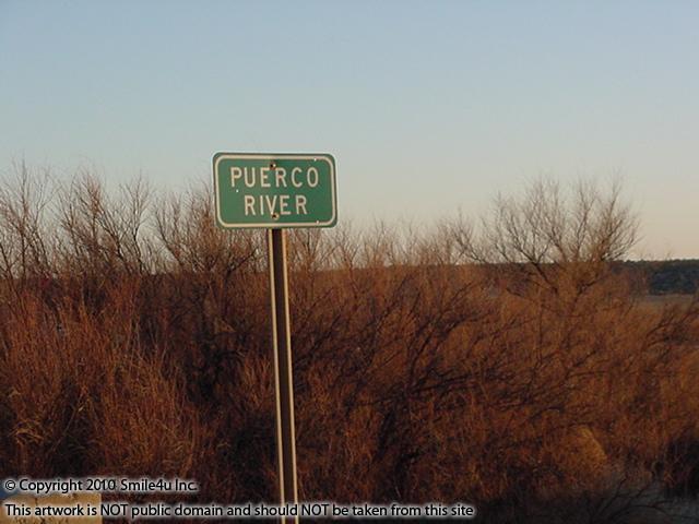
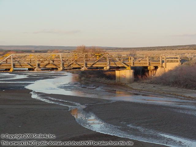
It sits about 1 mile as the crow flies from Chevelon Canyon which is a tributary to the Little Colorado River. Chevelon Canyon flows from the Apache Sitgreaves Forest near Heber north to the Little Colorado River near Winslow. There's an old one lane bridge that crosses Chevelon Canyon near Joseph City that really gives you a great idea of just how big this canyon is! People hunt antelope out in this area and hike this part of the canyon.
.JPG)
.JPG)
McHood Park sits along Clear Creek about 6 miles SE of Winslow and is a favorite spot for the locals to float the river, climb the canyon walls and fish! I have spent an afternoon floating this lazy creek!
.JPG#)
This sure is a unique little area just outside of Winslow and would be a great place for someone looking for a spot to hang out on the weekends! Enjoy! Char the Explorer : )
Financing Price: $8250 Per Lot
Terms with $250 down payment: $8000 at 8% interest with approximately 55 monthly payments of $175.
180 Days Work Like A Dog Early Payoff with $250 down! If $5500 of principal is paid in the first 180 days from the contract date Smile4u will waive the remaining balance!
The down payment applies to the180 day early payoff amount.
We will write the early payoff option into the contract. If at any time during the 180 day period you hit that amount we will waive the remaining balance and deed the property to you. Dream big!
You must pay off the contract prior to using the land. We don't mind if you go visit it a couple weeks out of the year if you let us know ahead of time. However you are not allowed to live on the property during the contract.
If purchasing a Contract for Deed Click Here to view the highlights of our owner financing.
Property Maps
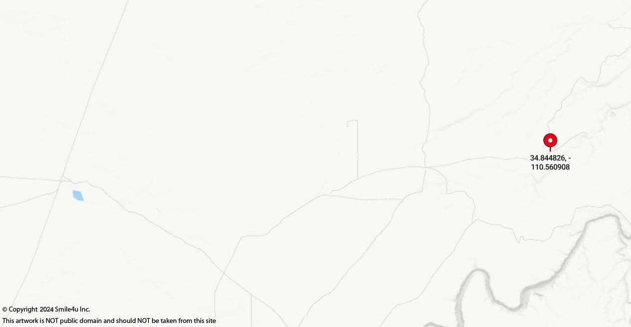
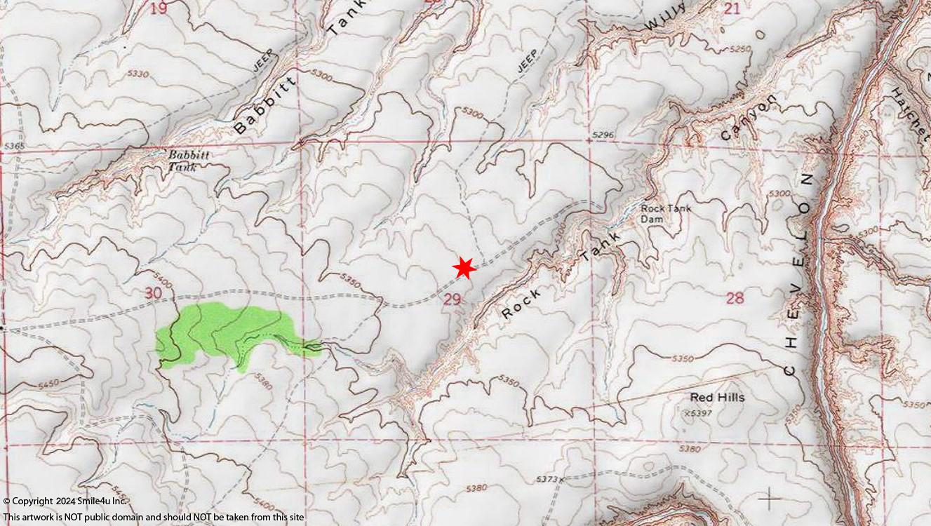
Prior to visiting the property I suggest you study the maps and the satellite image as they tell the story on how to get there. Get a mental picture of how to get to a property from a main road. I frequently write notes on how I got to the property.
Print out the important maps like the parcel map, aerial photo with the GPS coords and street map. These are the maps I use myself if I was going to view the property. You can enter the latitude and longitude into Google or Bing maps by putting a comma between them.
I also suggest you bring a street dedicated GPS like a Garmin, not your phone. Do not rely on your GPS to take you the correct way as she'll take you down miles of roads that aren't the main drags. I've named mine Thelma and Louise because she's tried to drive me off a cliff a few times! If I could just get Brad Pitt to sit in the back seat! : )
Most of the properties I sell are down some kind of dirt road - my favs! Be smart and bring a shovel, water, food, blankets, mace, a dog and anything else you might need if you get stuck for a day or two. I've been stuck in the sand, a marsh, had tires blow out - you name it. Be prepared, be safe, and have fun. She's a beautiful Earth. We only get one shot here - get out there and see all she has to offer. Char the Explorer : )
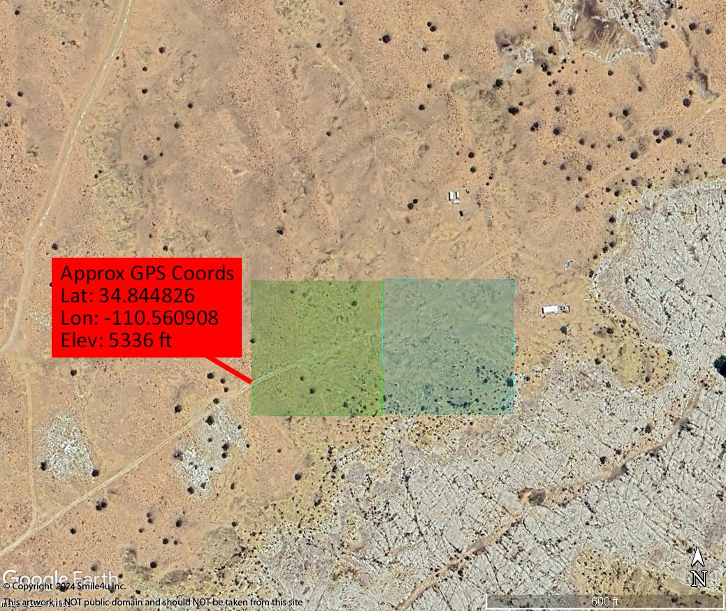
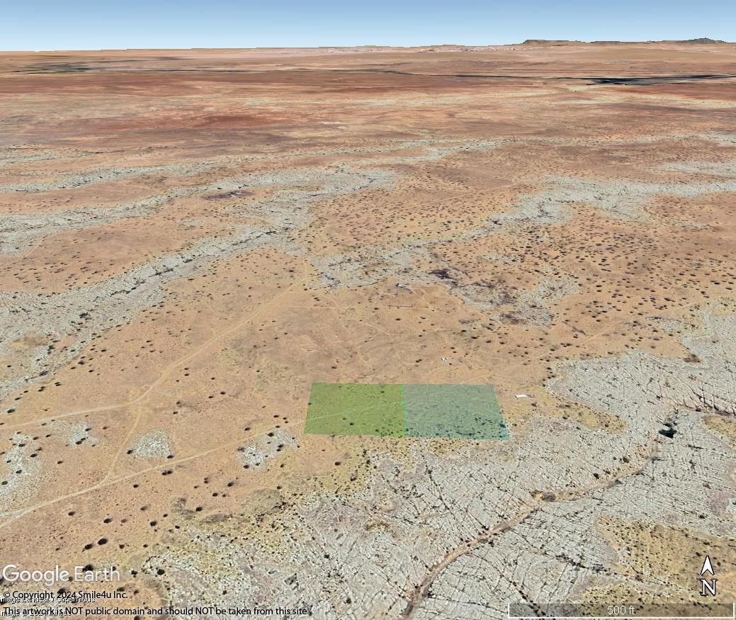
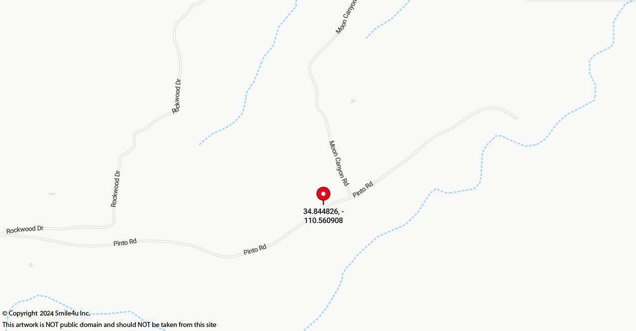
Approximate parcel GPS coordinates:
Parcel: T17N R17E Sec 29 Tract K-70
Latitude: 34.844826
Longitude: -110.560908
Coordinate location: to the W side of lot K-70 where the road enters.
Google Interactive Road Map based on CoordinatesBing Interactive Road Map based on Coordinates
Apache and Navajo County Area Information
Apache County has a population of about 69,423 and encompasses 11,216 square miles. The Apache and Navajo Indian Reservations cover more than 65.4% of the county and more land is designated Indian Reservation than any other county in the USA. Approximately 21 percent is public land and 13.2 is privately owned so majority of the land is not for sale. Its also home of the Petrified Forest National Park and Canyon de Chelly National Monument.
Adjoining to the west is Navajo County with a population of about 107,500, encompasses 9,960 square miles. Many people think that Arizona is a vast, open desert without vegetation but Navajo County offers Monument Valley, Keams Canyon, part of the Petrified Forest National Park, and the largest stand of Ponderosa Pines in North America.
The counties offers extreme diverse regions with the forested White Mountains and green pastures in the south and high, dry, colorful plateau regions to the north. The Petrified Forest National Park and Painted Desert that we learn about in our elementary school geography books, offer visitors a spectacular journey into prehistoric times.
The dinosaurs originally came to the banks of the Little Colorado River and then the Indians. Pioneer families arrived from the east in the early 1880's. Scattered over the greater portion of the county and especially along the Colorado Chiquita River are many ruins of a prehistoric people. There is plenty of pure spring water in every town and village in the county, constantly fed by the rains and melting snow in the mountains.
The area is gorgeous and not what you would typically think of when you think of the desert. With elevation ranging from 4,000 to 10,000 feet, plush green pastures with animals grazing in the plateau region to the north and the snowcapped ski slopes in the White Mountains to the south offer a picturesque setting. The area has four seasons with warm summer months and a few snow days in the wintertime. The snow usually melts in the lower altitudes in a day or two but the White Mountains become a wintertime playground.
Excellent fishing, hunting and skiing make the White Mountains a year-round recreation area for many living in the hot Phoenix sun. It is home of the Apache-Sitgreaves National Forests with 8 notable cold water lakes and numerous lakes and reservoirs: Aker Lake, Big Lake, Woods Canyon Lake, Willow Springs Lake,Black Canyon Lake, Chevelon Canyon Lake, Luna Lake, Bear Canyon Lake, Crescent Lake, and Blue River. There are over 680 miles of rivers and streams and the headwaters for the Black, Little Colorado and San Francisco rivers are in the White Mountains.
Click here for the White Mountain Apache Tribe Game and Fish website.
Click here for Arizona Game and Fish
Click here to visit The Petrified Forest National Park and Painted Desert.
Click here for the Apache-Sitgreaves National Forest.
Click here for the White Mountains Arizona website for recreational opportunities.
Click here for Walnut Canyon National Monument's website.
Click here for Canyon de Chelly National Monument's website.
Click here for Wupatki National Monument's website.
Click here for Rainbow Bridge National Monument's website.
Click here for information on Lake Powell.
Click here for information on Horseshoe Bend.
Click here for information on Monument Valley.
Click here for information on Antelope Canyon.
Sales Process and Terms
Please conduct your due diligence research and be sure to ask all questions prior to hitting the "Buy Now" button below.All of the maps and information provided in this listing are intended to assist you in your due diligence research. We try and include many resources that we use ourselves. Over the years we have found information to be incorrect like a road that shows on an aerial photo or street map that we can't find because it is overgrown or doesn't exist or a difference in GPS settings. So while we try and include as much of this information as possible we greatly encourage you to carefully do your research to be sure the property suits your needs.
If you would like to purchase this property click on the "Buy It Now" button at the bottom of the listing. A form will ask for your name, email address and phone number. There is a box to indicate if you are purchasing if for cash or financing. Once you click submit it will change the Status at the top of the listing from "Available" to "Sale Pending". We will hold it for you for 3 days. We will then send you an email that confirms our agreement and our process to complete the transaction. Please contact us within 24 hours of receiving that email from us and we will continue to hold the property for you.
Payment is due within 3 days unless prior arrangements are made. You can either send a cashier's checks or money orders, or you can call the office with a debit or a credit card. We often have several interested buyers in the same property and in fairness we keep the property available until someone is 100% prepared to complete the transaction.
If purchasing for cash, once we have received payment we will prepare all documents necessary to transfer ownership and even include a check to cover all recording fees and transfer taxes as well. It's all part of the non-refundable $150 doc prep fee!
If purchasing a Contract for Deed Click Here to view the highlights of our owner financing. PLEASE READ THIS DOCUMENT PRIOR TO CLICKING THE BUY IT NOW BUTTON FOR CONTRACTS!
With my sincere thanks,
Char : )
Please feel free to call me at 360-550-8943 with any questions!


.JPG)
.JPG)
.JPG)
.JPG)
.JPG)
.JPG)
.JPG)
.JPG)
.JPG)
.JPG)
.JPG)
.JPG)
.JPG)
.JPG)
.JPG)
.JPG)
.JPG)
.JPG)
.JPG)
.JPG)