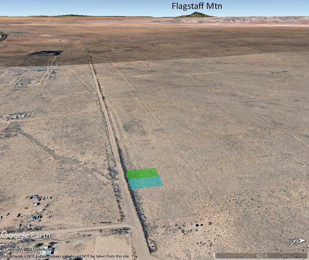
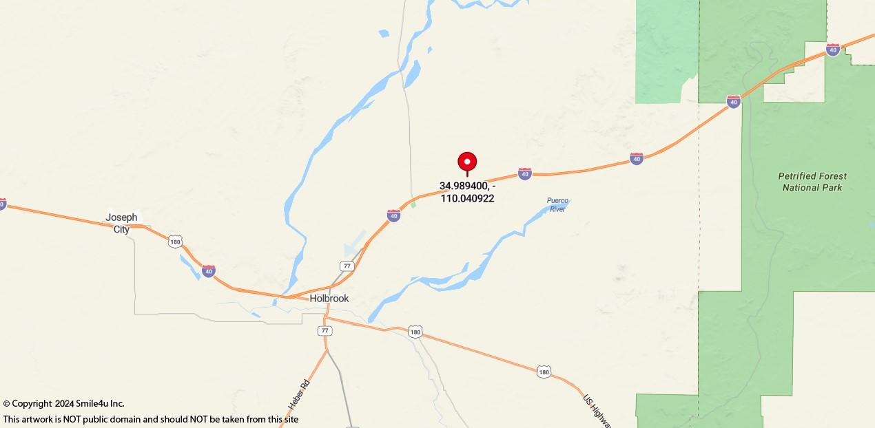
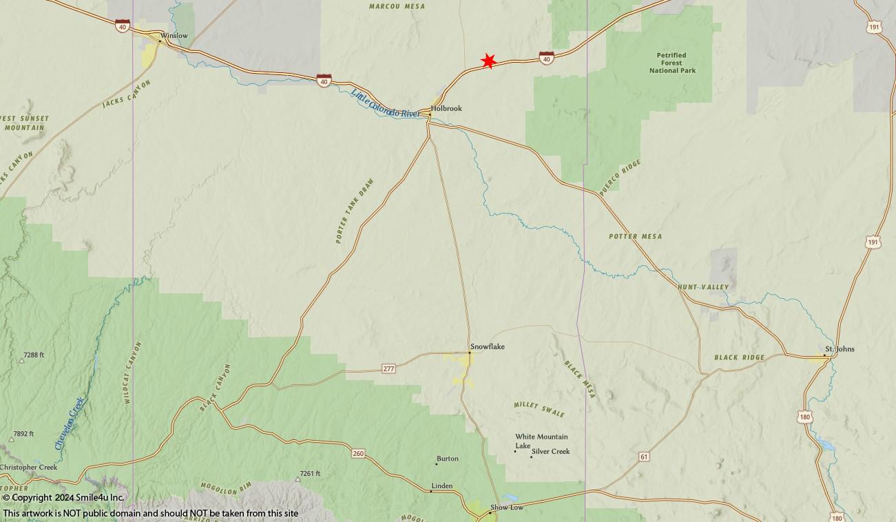
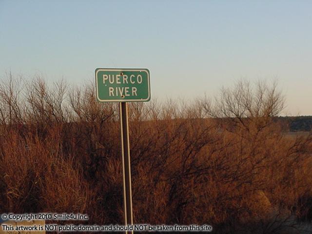
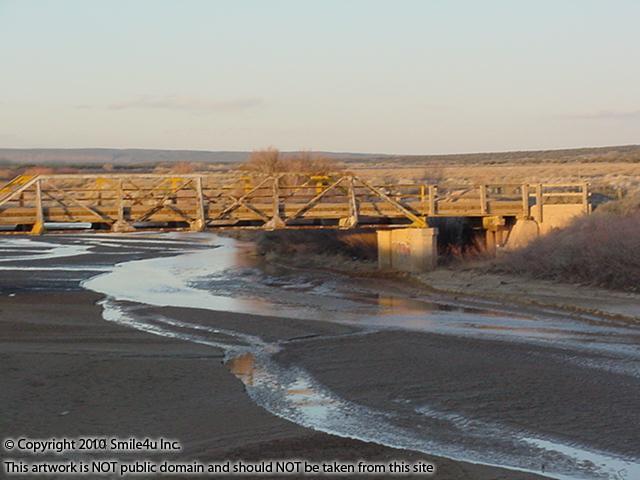
The beautiful mesas that sit across the other side of Sun Valley are part of the Petrified Forest National Park. This sure is an interesting area, home of the dinosaurs and petrified wood! It's about 10 minutes NE of Holbrook, 1.5 hours E of Flagstaff and 3.5 hours NE of Phoenix.
0.42 Acre of Cheap Land For Sale in Holbrook, Arizona With Power Close.
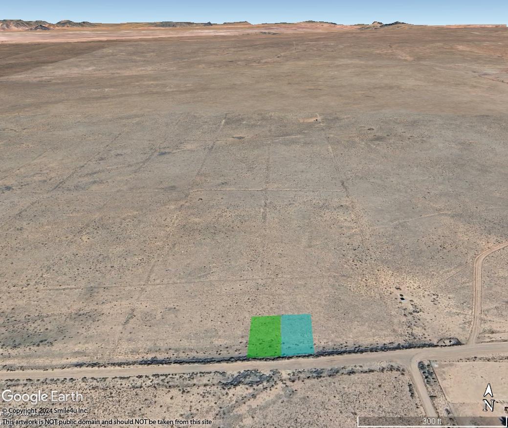
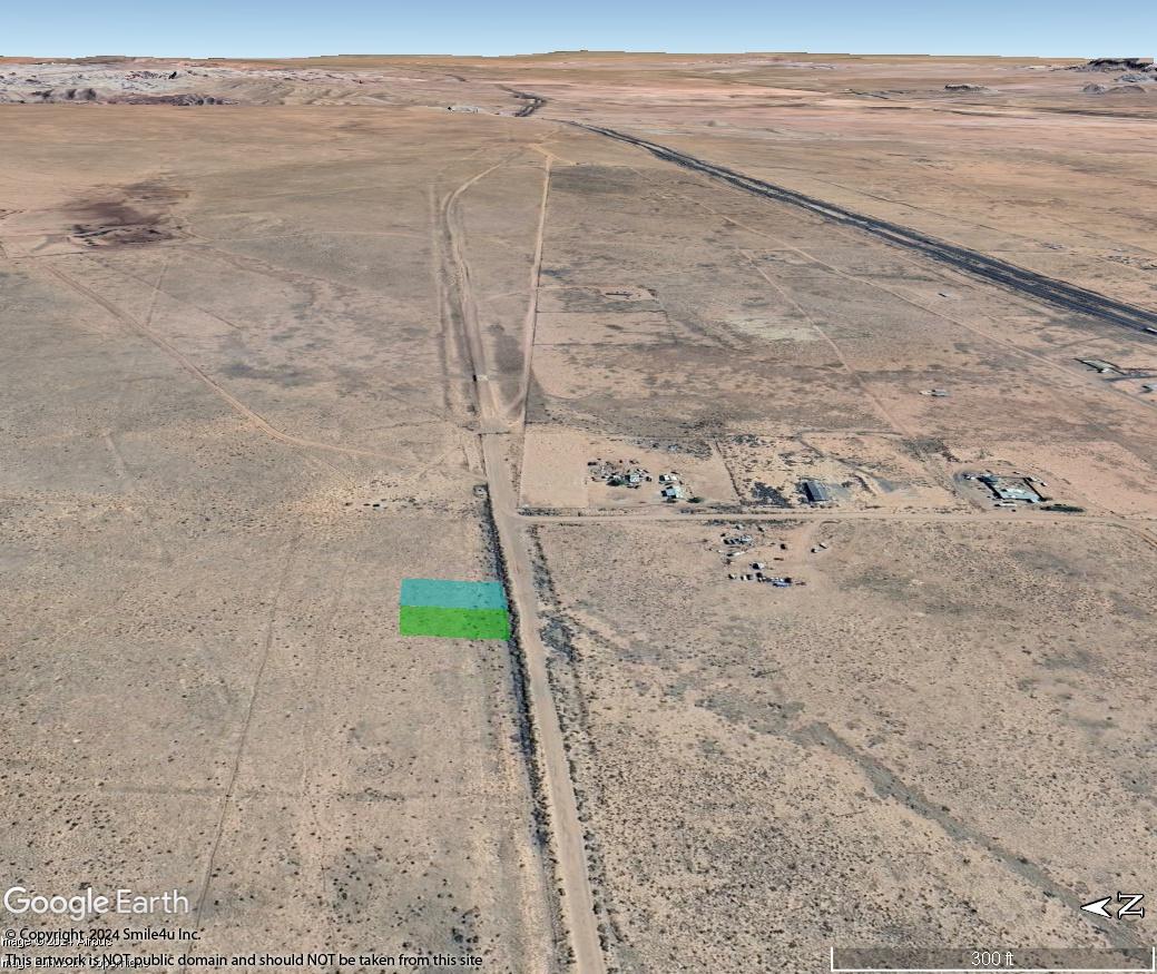
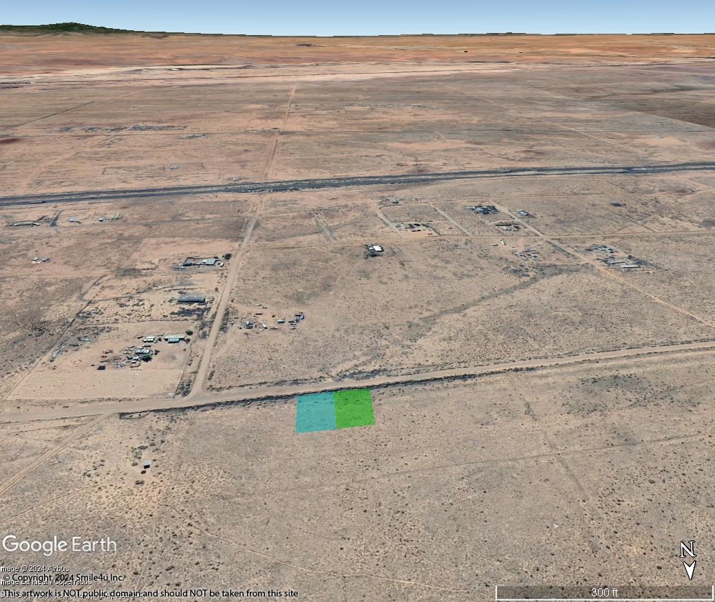
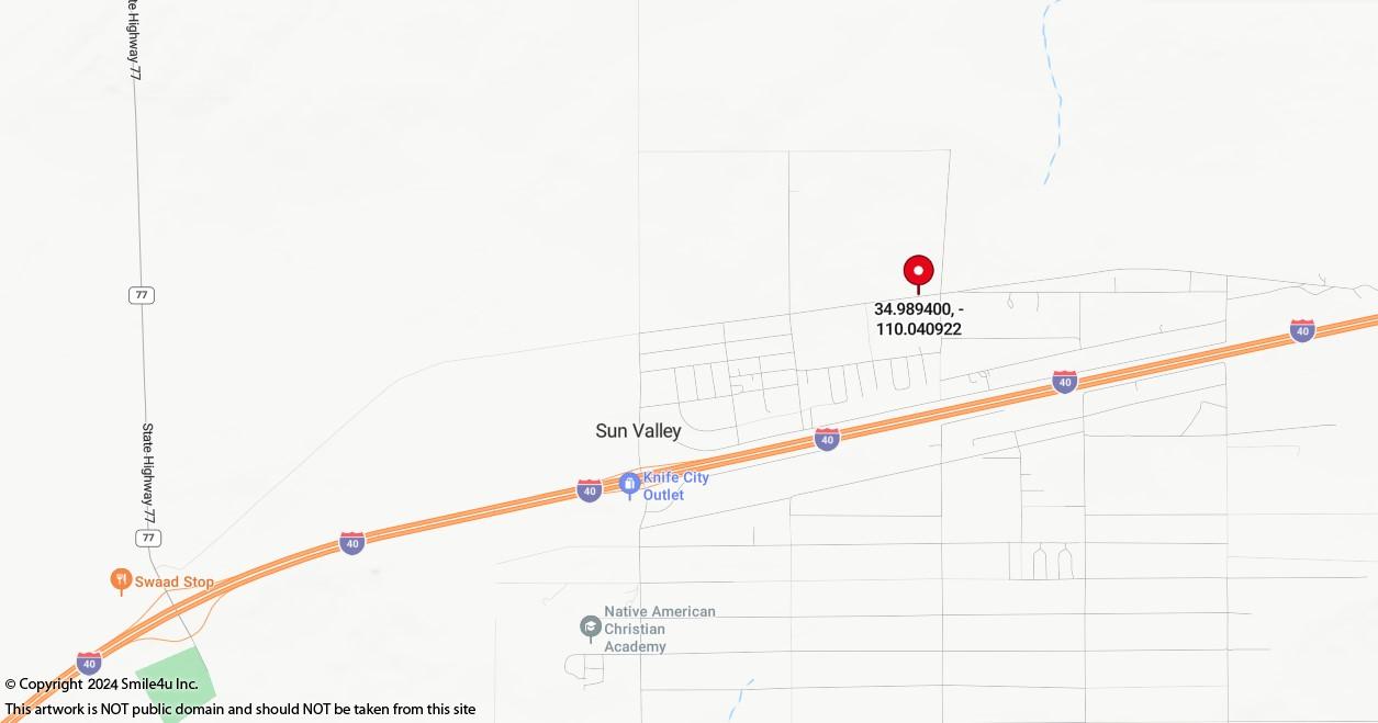
2 Adjoining Lots Being Sold Together Close to the Interstate 40 Sun Valley Exit.
18 Miles West of the Petrified Forest National Park, Home of the Painted Desert
Zoned Home, Manufactured Home & Some RV Use.
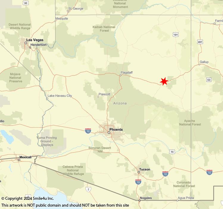
About 3.25 Hours NE of the Phoenix Sky Harbor Airport Between Flagstaff, AZ and Gallup, New Mexico
Views of the White Mountains and Woodruff Butte!
Call Char 360-550-8943 Mon - Sun
I love talking about the lands I explore!
Land Wholesaler - I Own Everything I Have For Sale!
180 Days Same As Cash Owner Financing With $100 Down!
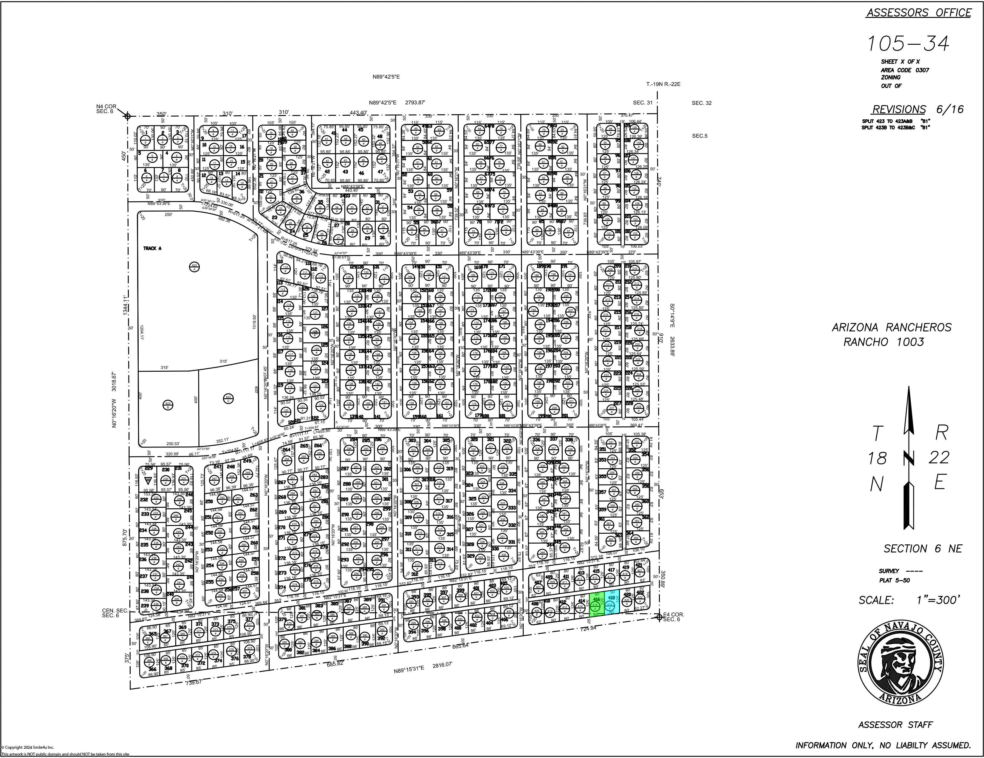
AZ Rancheros Rancho #1003 Lots 416 & 418
Status: Available
Sale: $2,850.00 Cash or Best Offer
See Listing For Owner Financing Price and Terms
State: AZ
County: Navajo

Parcels
Listing Details
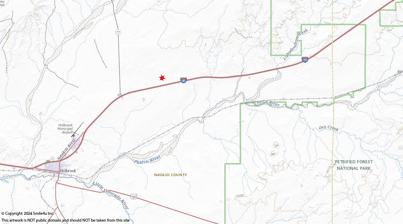
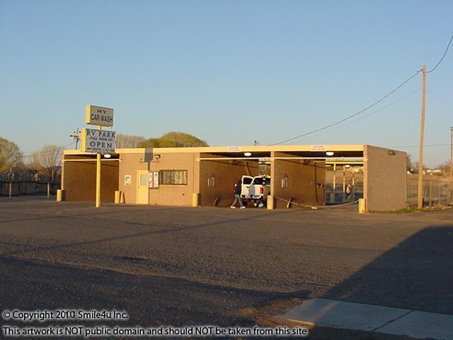
Holbrook is 9 miles SW
Flagstaff is 99 miles W
Gallup, NM is 106 miles NE
Phoenix is 190 Miles SW
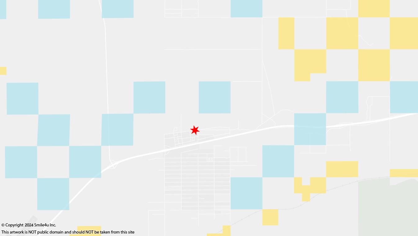
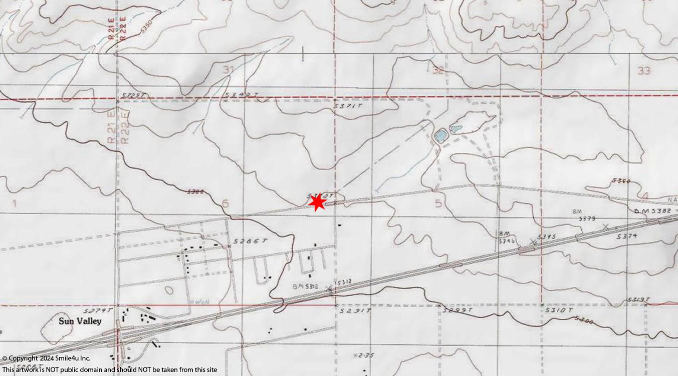
See parcel map.
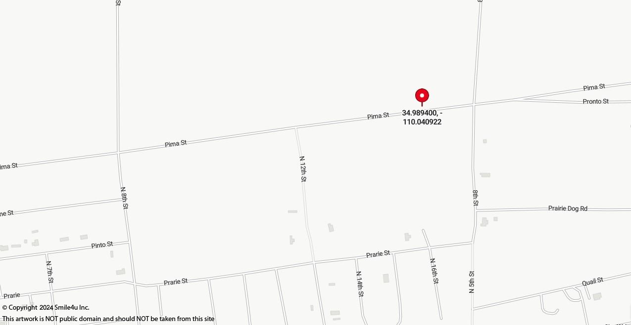
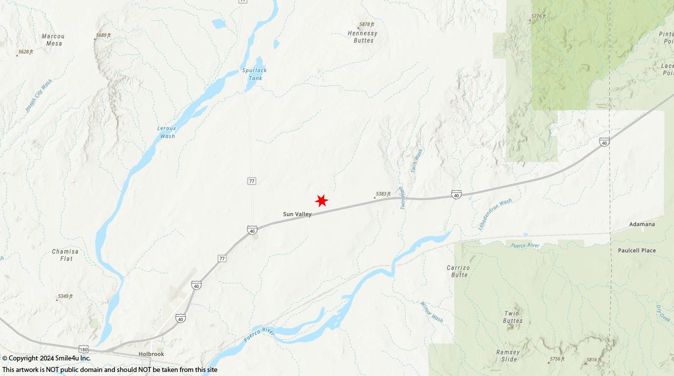
Take Sun Valley Road north off Interstate 40 to Pima Street, then East to lots.
There is a fence running along the south of the property and you will need to verify with the parcel map how to come in
See notes and maps below.
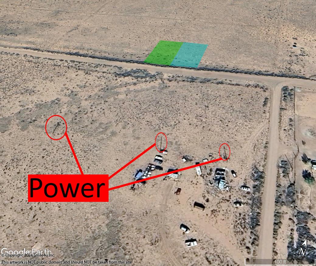
You would need to contact the local power company for the cost to bring it to the property.
Must have 100 feet between septic and well.
Click here to visit the Arizona Department of Water Resources website for information about well permits.
Click here to visit the Registry of Wells in Arizona to research the depth of any wells in the area.
Click here to visit the Arizona Department of Environmental Qualitys website for information about septics.
Must have 100 feet between septic and well and 50 feet setback off property lines.
30 days RV use without permit or 1 year with a building permit.
Click Here to read the Navajo County zoning for A General.
Property Photos
To view larger maps/photos just simply click the thumbnail to expand. You can scroll by using the arrow keys on your keyboard as well.
To view the maps/photos in a larger window hover your mouse over the small image, right click and then choose "Open Link".
Make sure to check the map section to see where photos were taken in relation to the property being sold in case the above named property is not the property being sold in this listing.
Navajo - Arizona Rancheros Rancho #1001 Lots 4 & 5 - Pics
All of the photos were taken in July 2021 of Arizona Rancheros Rancho #1001 Lots 4 & 5 and the surrounding views.
To view larger maps/photos just simply click the thumbnail to expand. You can scroll by using the arrow keys on your keyboard as well.
To view the maps/photos in a larger window hover your mouse over the small image, right click and then choose "Open Link".
Make sure to check the map section to see where photos were taken in relation to the property being sold in case the above named property is not the property being sold in this listing.
0.42 acre of land for sale in Holbrook, Arizona about 3.5 hours NE of Phoenix and 1.5 hours E of Flagstaff. It sits close to Interstate 40 and has views of the mesas in the Petrified Forest National Park and Painted Desert! It's made up of 2 adjoining lots being sold together and there's power close
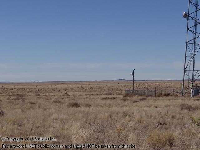
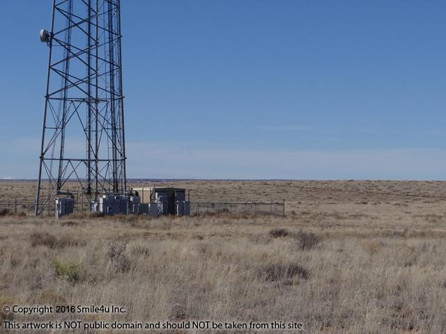
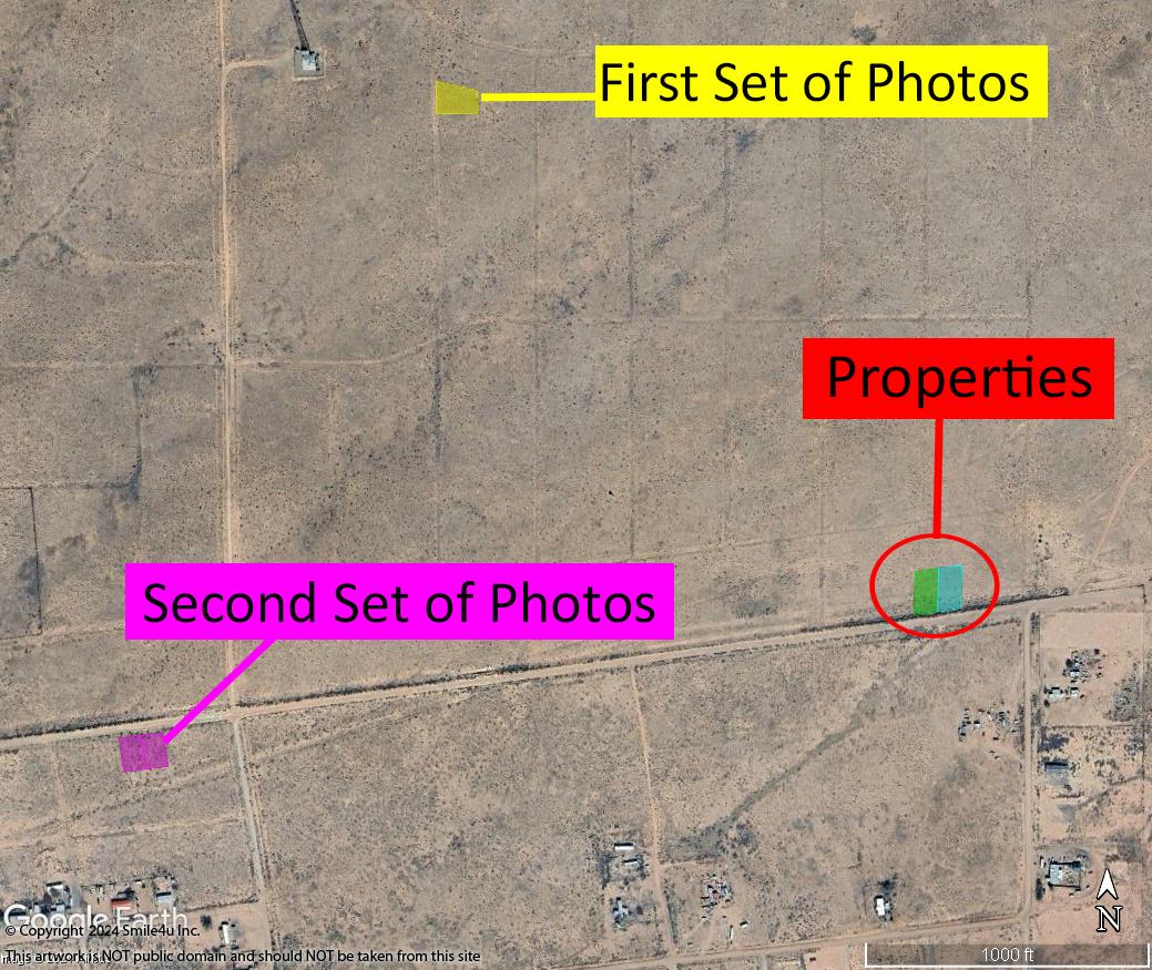
The first set of photos was taken about 1/2 mile NW of the property near the cell phone tower in January 2016. The second set of photos was taken in July 2021 1/2 mile W along Pima Street. Pima Street is a graveled sandy road along the south.
Take Sun Valley Road north off Interstate 40 to Pima Street, then E to the lots. There is a fence running along the south of the property and you will need to verify with the parcel map how to come in. In the aerial photos it looks like there is a break in the fence line just 3 lots to the east and then an overgrown dirt road leads along the fence line to the lots.
A jackrabbit raced along the road as I pulled up - too cute! Looking west down Pine Street about 1/2 mile away from the lots.
.jpg)
Hiding really still so I dont see him! Ha!
.jpg)
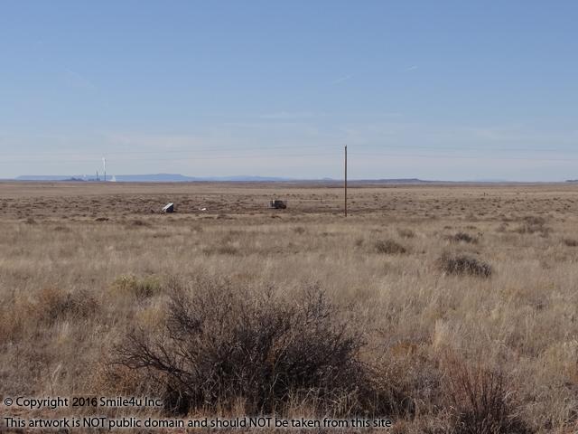
Looking east down Pine Street - the property sits on the left hand side of the road. You can see the power sitting at the end of the block m and the fence line that runs along the south of the lots.
.jpg)
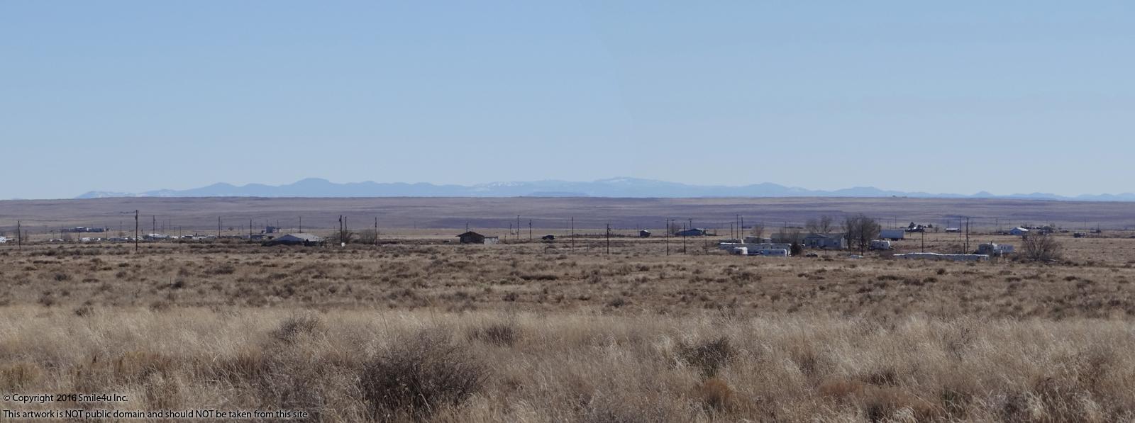
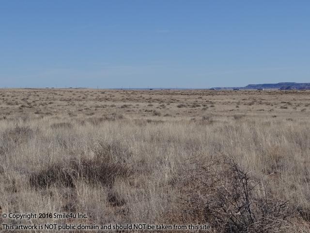
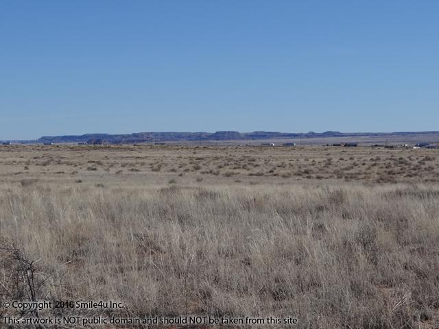
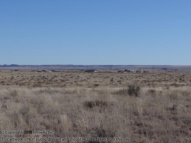
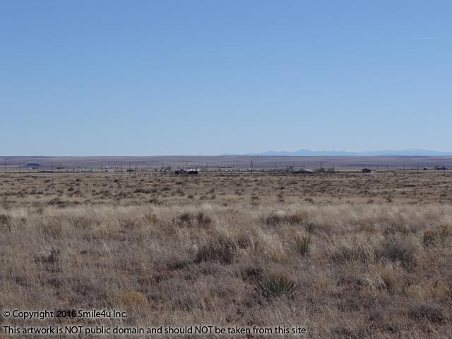
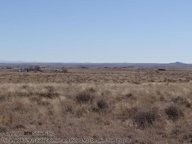
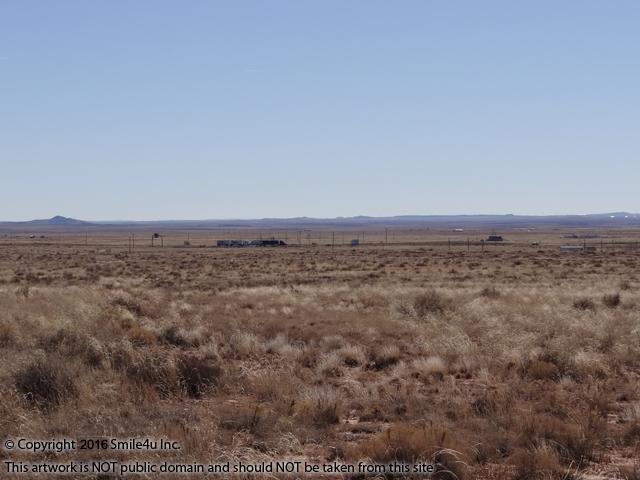
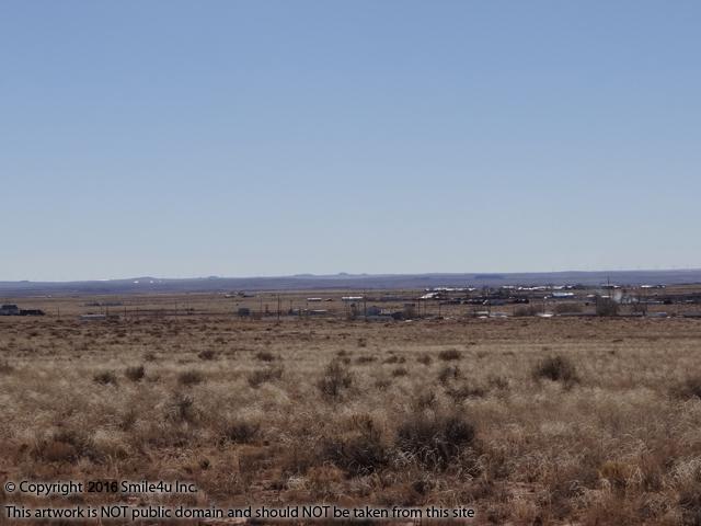
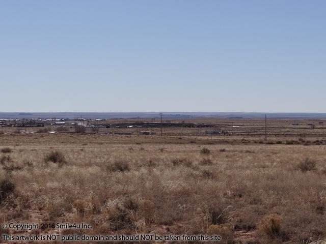
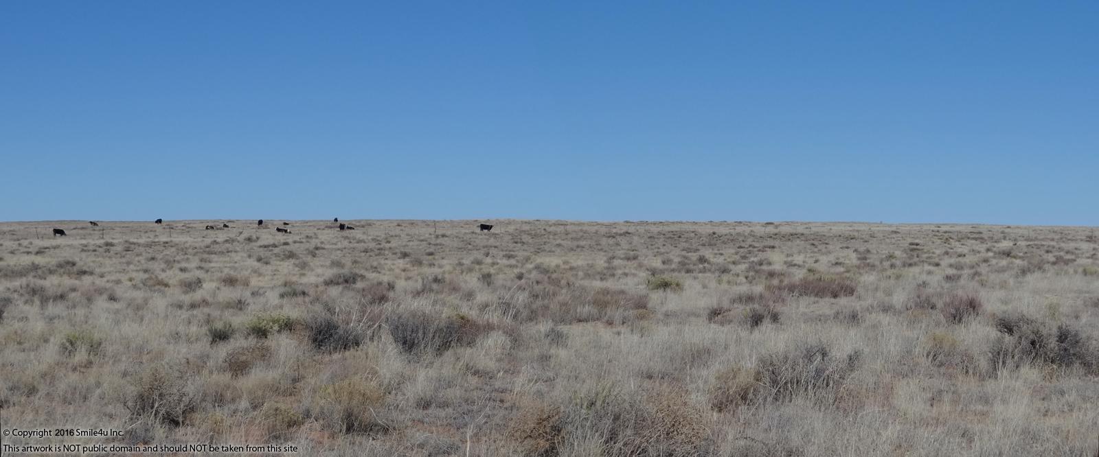
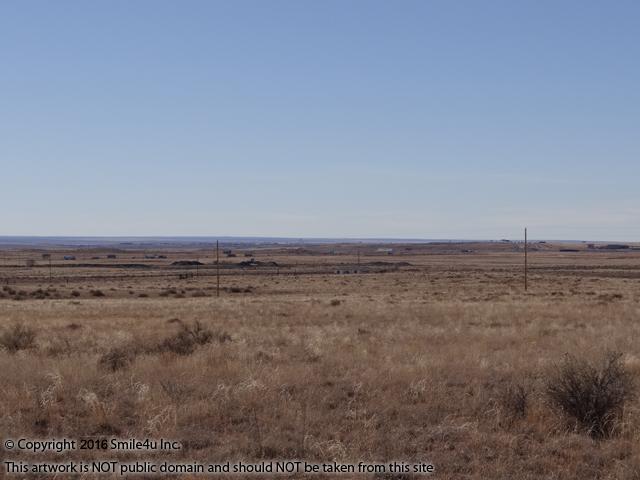
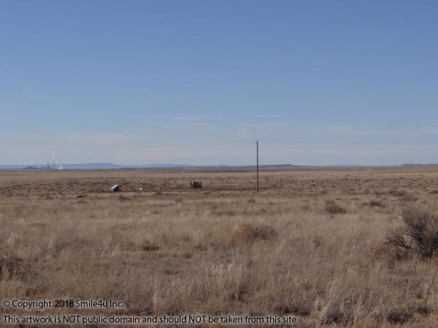
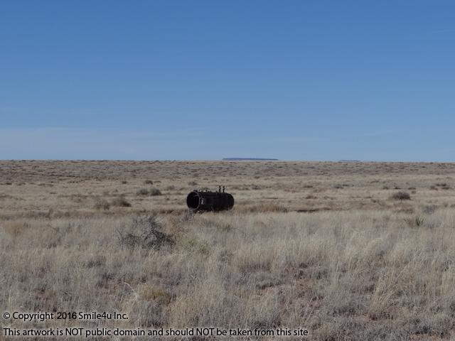
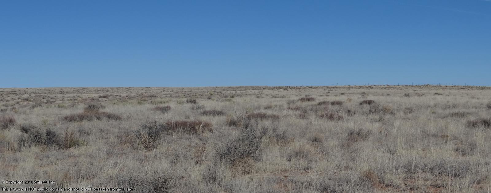
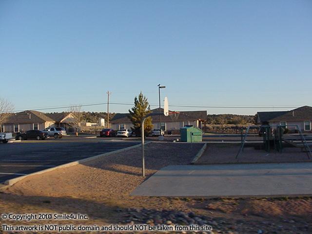
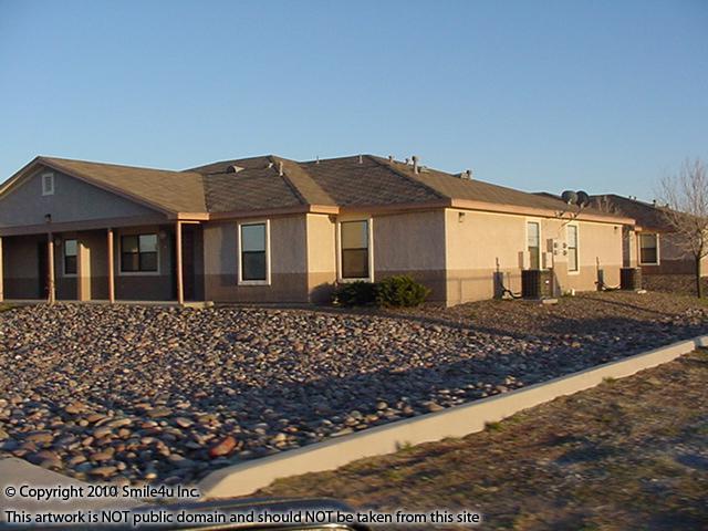
The area is mostly flat with scattered vegetation. There's several scattered homes in the area from the SW to the SE. It's a wide open view of the Colorado Plateau and in the far distance are peeks at the mesas.
.jpg)
.jpg)
To the NW about 1/2 of a mile is a cell phone tower.
.jpg)
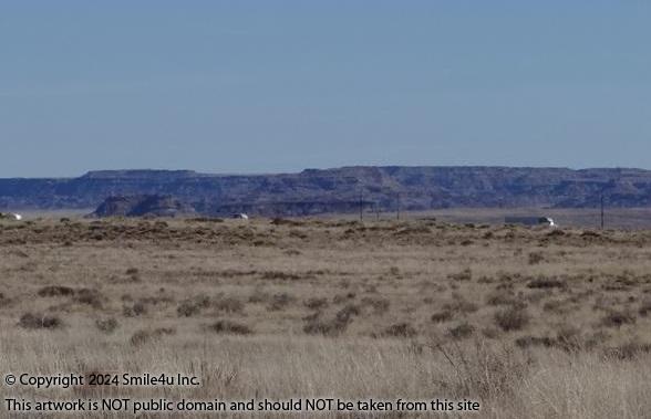
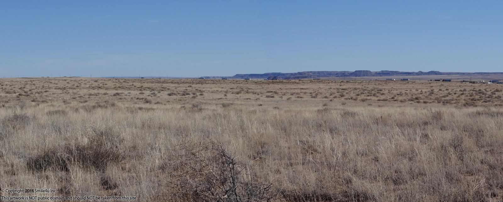
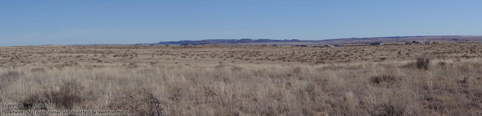
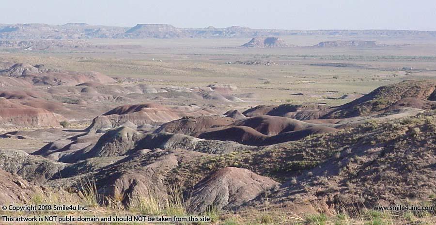
From the SE to the S is a pretty view across the valley to the mesas by the Petrified Forest National Park.

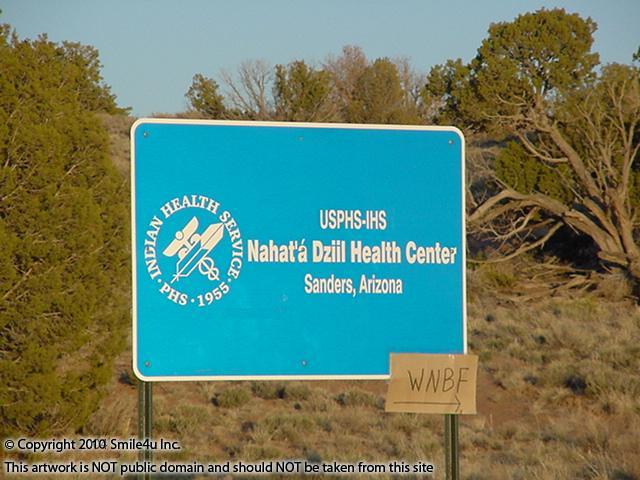
Woodruff Butte rises to 5,633 feet across the valley to the South about 13 miles. Woodruff is a picturesque little town off the beaten path in Navajo County.
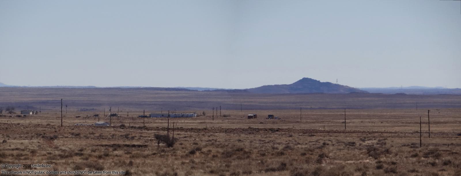
And way across the other side of the valley are the White Mountains, home of Smile4u Inc!
The onramp onto Interstate 40 sits 1 mile SW. There's some gravel piles by the onramp I assume are for the roads in the wintertime.
.jpg)
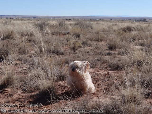
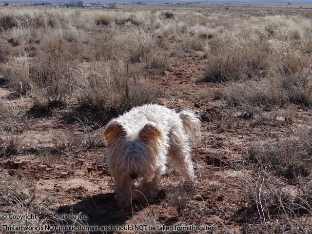
Awww look at that - Buddy was out here helping me! RIP My Little Man!
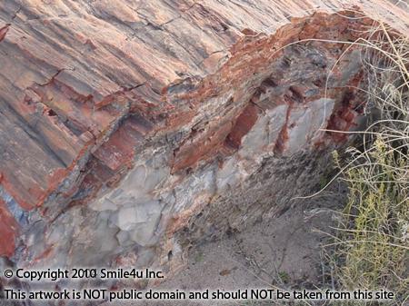
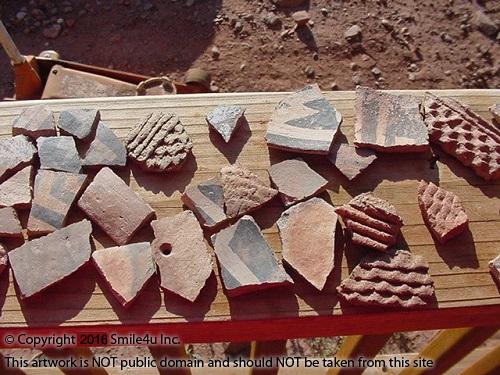
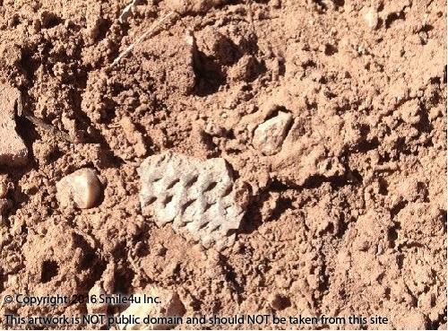
I have been here a few times now and have easily found painted and stamped pottery as well as petrified wood! I've read that the painted pottery is about 1000 years old and the stamped pottery is 10,000 years old. It sits about 20 minutes west of the Petrified Forest National Park which documents over 13,000 years of human occupation in this area! Part of the park contains the Painted Desert, a strangely beautiful landscape with intriguing land forms with multi-colored layers - truly a magnificent sight! I collected this pile a few years ago!
.jpg#)
Here's a bit of information about the petrified wood from their website: "Petrified wood found in the park and the surrounding region is made up of almost solid quartz. Each piece is like a giant crystal, often sparkling in the sunlight as if covered by glitter. The rainbow of colors is produced by impurities in the quartz, such as iron, carbon, and manganese."
The White Mountains are considered the playground for people in the Phoenix and Tucson areas who wish to escape to the cooler temperatures of the higher altitude. It's the home of the Apache/Sitgreaves National Forests and White Mountain Apache Reservation. It is the second highest mountain range in Arizona. It's also home of Smile4u!
In the past few years I've fished a few lakes, hiked a few canyons, found Native American pottery shards and petrified wood, taken quad rides, harvested a Christmas tree from the forest, driven over a few one lane bridges, seen a few waterfalls, floated the creek, seen a couple hundred beautiful sunsets, adopted a homeless cat we named Winslow, explored pueblo ruins of the Native Americans, and spotted herds of elk and antelope.
.JPG#)
The Apache/Sitgreaves National Forests, often called the White Mountains, and White Mountain Apache Reservation is the second highest mountain range in Arizona. It is very diverse geographically and culturally and known for it’s outstanding fishing, camping, hiking, hunting, golfing and in the winter months cross-country, downhill skiing and snowmobiling. It is home to more than 400 species of animals including antelope, elk, deer, fish, big horn sheep, mountain lions, black bears and gray wolves. With over 450 miles of streams and 50 lakes with over 2000 surface acres of cold water lakes, many fisherman, bird watchers and hunters are drawn to the area. It also offers winter time recreational fun like skiing and snowmobiling.
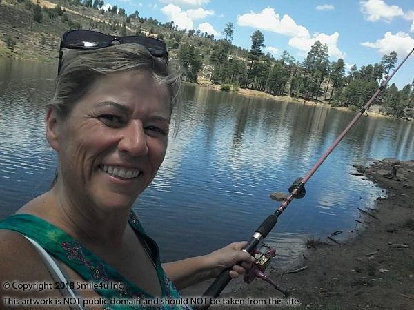
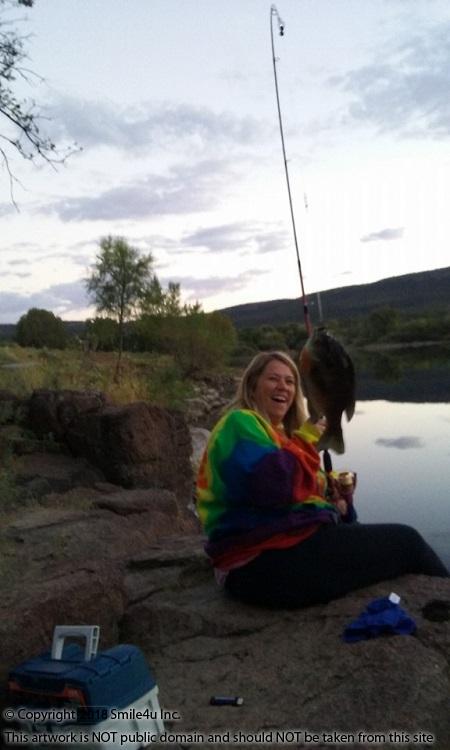
Here are a few of my fishing adventures these past few years: I fell in love with Big Lake in November 2015 and included a few photos of fisherman out having fun! It is considered one of the White Mountains best fishing lakes because of its size and amount of trout caught. I asked these guys what they were catching and they said catch and release trout because they had so many fish already.
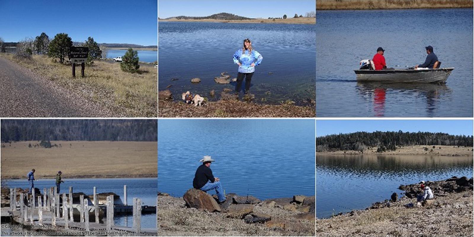
Fishing at Black Canyon Lake on my 52nd birthday! I caught my face and my middle finger!
The first fish I caught in the White Mountains was this giant blue gill on the Fort Apache Reservation near the Salt River Canyon! I let him go!
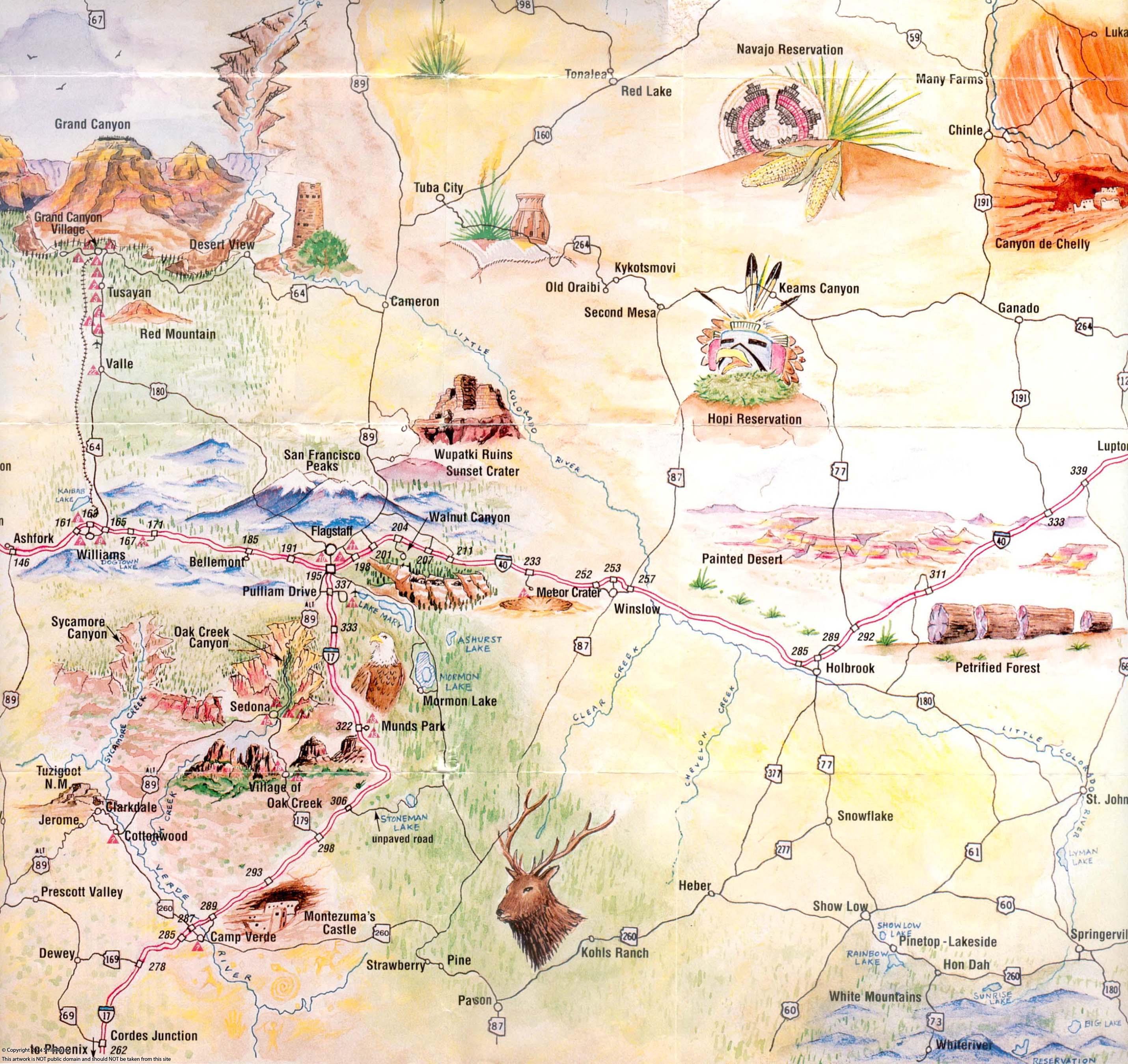
Within two or three hours are some of the most interesting Indian ruins and parks to explore including Canyon de Chelly, Window Rock, Monument Valley, Walnut Canyon and Wuptaki National Monument. My favorite spot to take visitors is to the Wukoki ruin which is part of the Wuptaki National Monument near Flagstaff. It resembles an old castle and is enormous and makes me marvel at how they made it by hand!
If you look closely you can see Buddy standing on the steps on the right hand side!
.JPG#)
One of the greatest adventures in my lifetime was my trip in 2017 to Monument Valley which sits about 200 miles NE of Holbrook. I met up with a Navajo guide Roger for a jeep tour of Mystery Valley and Monument Valley. At one point he beckoned me to sit beside him as he painted a Kokopeli with sand on a rock in front of one of the ruins. He first spent a moment touching the rock with his hands, feeling it. I sat quietly and watched so mesmerized by how quickly the image came to life.
.JPG)
Roger had been joking with us that if we listened we would hear the Kokopelis flute calling us to him. Apparently he calls all the ladies, a modern day Casanova. He was said to travel to villages bringing the change of winter to spring, carrying a sack of seeds and songs on his back. He is the source of human conception and everyone would sing and dance when they heard his flute. The next morning every maiden in the village would be with child.
.JPG)
When we were done I said we should say a prayer or something - it was so spiritual. And before we left Roger walked over to the rock and said a quick prayer then used a stick to erase the image. I asked him what he had said in his native tongue and it was something along the lines of "I did not have the right to draw on this rock and I have erased it to show respect."
.JPG)
In 1906, President Theodore Roosevelt set the land aside as a National Monument. Petrified wood is a fossil of a fallen trees that became a rock and they are strewn about the park.
The badlands are incredibly unique painted landscapes called the Painted Desert and can be seen in the northern part of the park. This is definitely my favorite part! I ran across badlands on my first visit ever to Navajo County while out exploring land by Sun Valley which is about 20 miles east of the park. It's called Little Lithodendron Wash, also known as Carrizo Wash. She is so stunning that I stop by every time I visit the area!
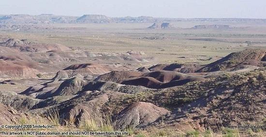
They have documented over 13,000 years of human occupation in the park. While reading about the preshitoric people who have called this home I got chills, hairs stood up on my arm! Some of the same tools and pottery found in the park are on my own property! I read that you can actually hike and horseback many trails within the badlands in the park.
Financing Price: $5700
Terms with $100 down payment: $5600 at 8% interest with approximately 53 monthly payments of $125.
180 Days Work Like A Dog Early Payoff with $100 down! If $2850 of principal is paid in the first 180 days from the contract date Smile4u will waive the remaining balance!
The down payment applies to the180 day early payoff amount.
We will write the early payoff option into the contract. If at any time during the 180 day period you hit that amount we will waive the remaining balance and deed the property to you. Dream big!
You must pay off the contract prior to using the land. We don't mind if you go visit it a couple weeks out of the year if you let us know ahead of time. However you are not allowed to live on the property during the contract.
If purchasing a Contract for Deed Click Here to view the highlights of our owner financing.
Property Maps
Prior to visiting the property I suggest you study the maps and the satellite image as they tell the story on how to get there. Get a mental picture of how to get to a property from a main road. I frequently write notes on how I got to the property.
Print out the important maps like the parcel map, aerial photo with the GPS coords and street map. These are the maps I use myself if I was going to view the property. You can enter the latitude and longitude into Google or Bing maps by putting a comma between them.
I also suggest you bring a street dedicated GPS like a Garmin, not your phone. Do not rely on your GPS to take you the correct way as she'll take you down miles of roads that aren't the main drags. I've named mine Thelma and Louise because she's tried to drive me off a cliff a few times! If I could just get Brad Pitt to sit in the back seat! : )
Most of the properties I sell are down some kind of dirt road - my favs! Be smart and bring a shovel, water, food, blankets, mace, a dog and anything else you might need if you get stuck for a day or two. I've been stuck in the sand, a marsh, had tires blow out - you name it. Be prepared, be safe, and have fun. She's a beautiful Earth. We only get one shot here - get out there and see all she has to offer. Char the Explorer : )
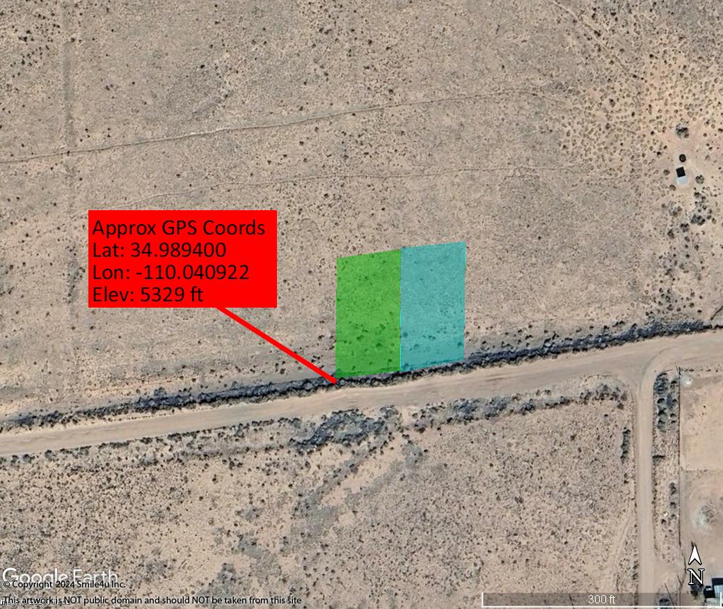
Approximate parcel GPS coordinates:
Parcel: Arizona Rancheros Rancho 1003 Lot 416
Latitude: 34.989400
Longitude: -110.040922
Coordinate location: SW corner of Lot 416
Google Interactive Road Map based on CoordinatesBing Interactive Road Map based on Coordinates
Apache and Navajo County Area Information
Apache County has a population of about 69,423 and encompasses 11,216 square miles. The Apache and Navajo Indian Reservations cover more than 65.4% of the county and more land is designated Indian Reservation than any other county in the USA. Approximately 21 percent is public land and 13.2 is privately owned so majority of the land is not for sale. Its also home of the Petrified Forest National Park and Canyon de Chelly National Monument.
Adjoining to the west is Navajo County with a population of about 107,500, encompasses 9,960 square miles. Many people think that Arizona is a vast, open desert without vegetation but Navajo County offers Monument Valley, Keams Canyon, part of the Petrified Forest National Park, and the largest stand of Ponderosa Pines in North America.
The counties offers extreme diverse regions with the forested White Mountains and green pastures in the south and high, dry, colorful plateau regions to the north. The Petrified Forest National Park and Painted Desert that we learn about in our elementary school geography books, offer visitors a spectacular journey into prehistoric times.
The dinosaurs originally came to the banks of the Little Colorado River and then the Indians. Pioneer families arrived from the east in the early 1880's. Scattered over the greater portion of the county and especially along the Colorado Chiquita River are many ruins of a prehistoric people. There is plenty of pure spring water in every town and village in the county, constantly fed by the rains and melting snow in the mountains.
The area is gorgeous and not what you would typically think of when you think of the desert. With elevation ranging from 4,000 to 10,000 feet, plush green pastures with animals grazing in the plateau region to the north and the snowcapped ski slopes in the White Mountains to the south offer a picturesque setting. The area has four seasons with warm summer months and a few snow days in the wintertime. The snow usually melts in the lower altitudes in a day or two but the White Mountains become a wintertime playground.
Excellent fishing, hunting and skiing make the White Mountains a year-round recreation area for many living in the hot Phoenix sun. It is home of the Apache-Sitgreaves National Forests with 8 notable cold water lakes and numerous lakes and reservoirs: Aker Lake, Big Lake, Woods Canyon Lake, Willow Springs Lake,Black Canyon Lake, Chevelon Canyon Lake, Luna Lake, Bear Canyon Lake, Crescent Lake, and Blue River. There are over 680 miles of rivers and streams and the headwaters for the Black, Little Colorado and San Francisco rivers are in the White Mountains.
Click here for the White Mountain Apache Tribe Game and Fish website.
Click here for Arizona Game and Fish
Click here to visit The Petrified Forest National Park and Painted Desert.
Click here for the Apache-Sitgreaves National Forest.
Click here for the White Mountains Arizona website for recreational opportunities.
Click here for Walnut Canyon National Monument's website.
Click here for Canyon de Chelly National Monument's website.
Click here for Wupatki National Monument's website.
Click here for Rainbow Bridge National Monument's website.
Click here for information on Lake Powell.
Click here for information on Horseshoe Bend.
Click here for information on Monument Valley.
Click here for information on Antelope Canyon.
Sales Process and Terms
Please conduct your due diligence research and be sure to ask all questions prior to hitting the "Buy Now" button below.All of the maps and information provided in this listing are intended to assist you in your due diligence research. We try and include many resources that we use ourselves. Over the years we have found information to be incorrect like a road that shows on an aerial photo or street map that we can't find because it is overgrown or doesn't exist or a difference in GPS settings. So while we try and include as much of this information as possible we greatly encourage you to carefully do your research to be sure the property suits your needs.
If you would like to purchase this property click on the "Buy It Now" button at the bottom of the listing. A form will ask for your name, email address and phone number. There is a box to indicate if you are purchasing if for cash or financing. Once you click submit it will change the Status at the top of the listing from "Available" to "Sale Pending". We will hold it for you for 3 days. We will then send you an email that confirms our agreement and our process to complete the transaction. Please contact us within 24 hours of receiving that email from us and we will continue to hold the property for you.
Payment is due within 3 days unless prior arrangements are made. You can either send a cashier's checks or money orders, or you can call the office with a debit or a credit card. We often have several interested buyers in the same property and in fairness we keep the property available until someone is 100% prepared to complete the transaction.
If purchasing for cash, once we have received payment we will prepare all documents necessary to transfer ownership and even include a check to cover all recording fees and transfer taxes as well. It's all part of the non-refundable $150 doc prep fee!
If purchasing a Contract for Deed Click Here to view the highlights of our owner financing. PLEASE READ THIS DOCUMENT PRIOR TO CLICKING THE BUY IT NOW BUTTON FOR CONTRACTS!
With my sincere thanks,
Char : )
Please feel free to call me at 360-550-8943 with any questions!


.jpg)
.jpg)
.jpg)
.jpg)
.jpg)
.jpg)
.jpg)
.jpg)
.jpg)
.jpg)
.jpg)
.jpg)
.jpg)
.jpg)
.jpg)
.jpg)
.jpg)
.jpg)
.jpg)
.jpg)